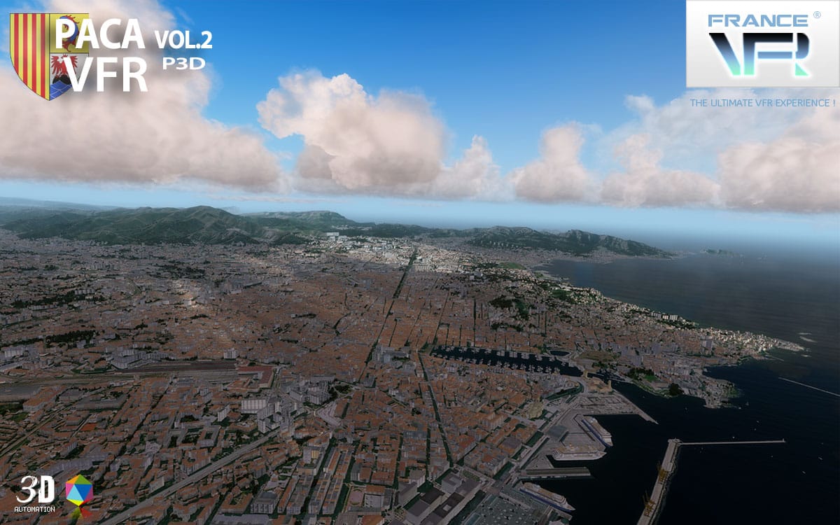
 FranceVFR confirm the expansion of their VFR series for Prepar3D V4 with the French Riviera covering the South East coasts of France facing the Mediterranean Sea. Available in two volumes, Vol.1 for the region with the Italian border and Nice, and the Vol.2 for the other side around Marseille.
The extensive Autogen and high density of buildings is allowed thanks to their exclusive 3D Automation technology. Later this year, FranceVFR will suggest extension pack for both sceneries (P3D v4 and FSX), to enable the night lighting scenery addon with higher resolution of photoreal textures.
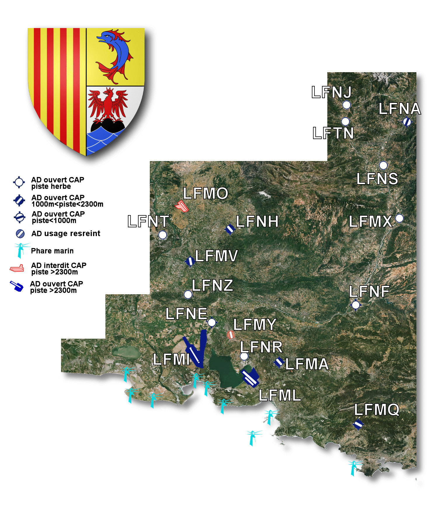
Map coverage of Volume 1 including Nice :
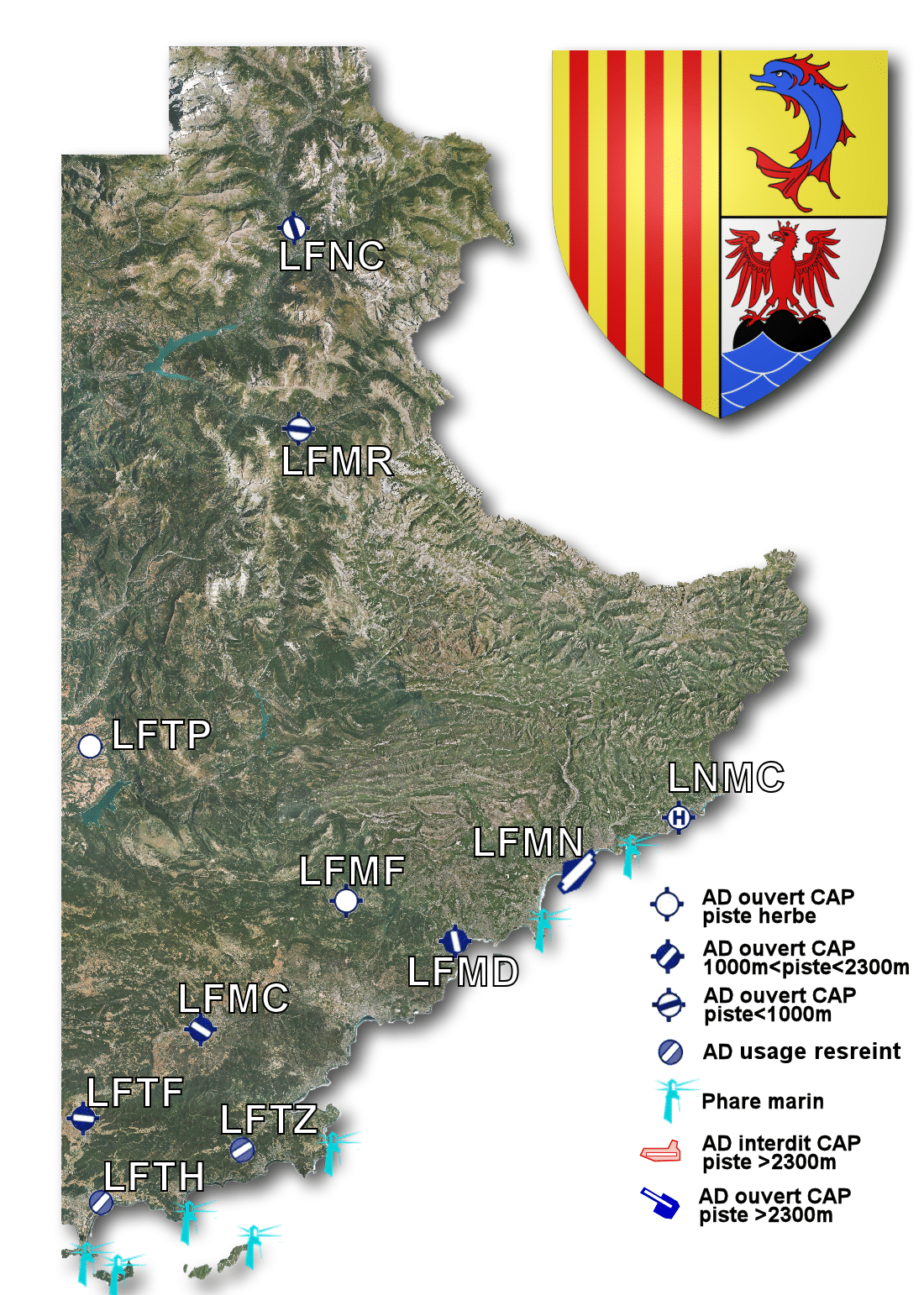
Map coverage of Volume 2 including Marseille :
Full press release :
After the last release of our Languedoc-Roussilon VFR scenery for P3Dv4, France VFR is proud to announce our last couple of VFR Sceneries : French Riviera VFR P3Dv4 Vol.1 and Vol.2.
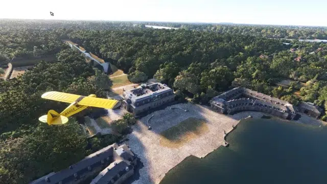
This very famous area covering the French Riviera south-eastern part of France is modelized with hundred thousand of 3D dedicated buildings and a very accurate vegetation using our 3D Automation technology !
This new scenery is fully compatible with the other 3D Automation VFR and Airports sceneries…
The new VFR Regional series was designed and developped to provide VFR flight an environment as realistic as possible. It is the result of years of experience and practice in flight simulation and 3D modeling.
“VFR Regional” products embed all enhancements from the new 3DAutomation® technology developed by France VFR. This technology already allows to generate the most realistic and dense environments ever seen. It does not intend to model real world accurately but to create a copy “as real as it gets” on a massive scale. It will evolve to adapt to the needs and new data available.
Features :
– Ground textures from 0.8 to 1.20 meter / pixel resolution from IGN aerial photography reworked for an optimal visual rendition in Prepar3D® (summer only).
– Dedicated mesh with high definition 4.75 meters (LOD13).
– Lakes and rivers with navigable waters fitting the texture.
– Transparency management of the seabed on the entire scene.
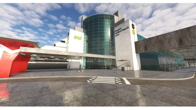
– Semi-detailed generic airports including flatten platform correction.
– Obstacles and VFR landmarks modeled on the entire scene including the official SIA database (antennas, towers, water towers, wind turbines, various constructions …).
– Hundreds of thousands of objects and notable buildings integrated into the environment (churches, power plants, silos, castles, industrial tanks, bridges, tolls, cranes, boats, streetlights, road signs …).
– Integration of 3D Automation® technology allowing multi-million buildings and realistic vegetation areas fitting geographic specs.
– Extremely dense and optimized vegetation coverage using a custom rendering module controlled by artificial intelligence (AI).
– Autogen buildings including additional specific and optimized 3D variations.
– Geo-referenced data for maximum compatibility with future add-ons installed on the same area.
– Development process 100% Lockheed Martin® SDK specifications compliant, ensuring maximum compatibility with new releases.