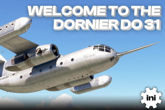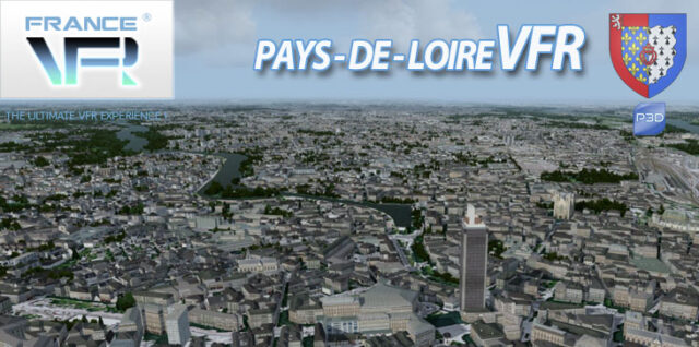
Their new Regional scenery Pays-de-Loire VFR 3DA for P3D (v5/v4) and FSX is now available ! This scenery represents the Northen-West area of France including many airports and famous cities.
With 3D Automation exclusive technology, France VFR achieves to recreate a large area for VFR flights at low altitude with excellent conditions : photoreal terrain, numerous landmarks and custom buildings, very dense and custom Autogen in local style
TECHNICAL SPECIFICATIONS:
– Ground textures from 0.8 to 1.20 meter / pixel resolution from IGN aerial photography reworked for an optimal visual rendition
– Dedicated mesh with high definition 4.75 meters (LOD13).
– Lakes and rivers with navigable waters fitting the texture.
– Semi-detailed generic airports including flatten platform correction.
– Obstacles and VFR landmarks modeled on the entire scene including the official SIA database (antennas, towers, water towers, wind turbines, various constructions …).
– Hundreds of thousands of objects and notable buildings integrated into the environment (churches, power plants, silos, castles, industrial tanks, bridges, tolls, cranes, boats, streetlights, road signs …).
– Integration of 3D Automation® technology allowing multi-million buildings and realistic vegetation areas fitting geographic specs.
– Extremely dense and optimized vegetation coverage using a custom rendering module controlled by artificial intelligence (AI).
– Autogen buildings including additional specific and optimized 3D variations.
– Geo-referenced data for maximum compatibility with future add-ons installed on the same area.
– Development process 100% Lockheed Martin® and Micosoft Fight Simulator X® SDK specifications compliant, ensuring maximum compatibility with new releases.

![Aerosoft – Frankfurt EDDF MSFS Preview [Video]](https://www.simflight.com/wp-content/uploads/2024/04/Aerosoft-Frankfurt-EDDF-MSFS-Preview-thumb.jpg)