There are well over 35+ airfields and/or airports in the Newfoundland Labrador region of Canada. About 20 of those are on Newfoundland and these two packages model 6 airfields/airports (3 per volume). Some are grass strips, but then St John’s International Airport, complete with balloons, is also modelled.
Gander International is missing, but I’ve heard that is coming at a later stage in another volume. These 6 Airports/Airfields/Strips definitely improve on the default FSX offerings and resemble their real life counterparts, with vastly improved and correctly positioned buildings, taxiways, parking and runways. There are a number of static and animated objects included adding to the realism.
If you like GA flying, this is a useful add on in a unique part of the world. There was no impact on frame rates day or night.
Newfoundland VFR Airports Vol 1 and Vol 2 — The Terra Nova Review
Geography: With apologies to Labrador
Newfoundland is a province of Canada, it is an island situated East of the Gulf of St Lawrence, ie off the East Coast of North America. It is located between Lat 36 47 to 51 40 and Long 52 41 to 59 31, and there is nothing more to the West until you come to Ireland. The Island is roughly triangular in shape and is approximately 42,000 square miles in area, and it is surrounded by over 7,000 large and small islands. It is on the same latitude as Paris, France, has cool summers and fairly cold winters, experiencing heavy snowfalls and thick impenetrable fogs. The main industries of the island are involved in timber, fish, and minerals. The population of Newfoundland and Labrador is approximately 510,000 with 94% living on Newfoundland Island itself.
(Ref: Wikipedia & http://faculty.marianopolis.edu/c.belanger/)
Installation:
Very easy two small exe files which expand into the add-on folder in FSX. Also downloaded are various charts and pictures plus the two manuals.
The Manual
There are two small concise manuals for each volume. They cover each of the 6 Airports/Airfields/Strips, giving a short description and location in Newfoundland. Also included are some brief but interesting notes about each area. Installed separately in the FSX\FSaddon folder are complete charts for 5 of the fields, plus 27 photographs of the relevant areas. Some of the charts are quaintly called “Aerodrome charts” something I haven’t heard in more years than I care to remember. My OED tells me that the term “Aerodrome” is largely obsolete in modern day parlance but usually means a landing area that is usually smaller than an airport. Oh Well, St John’s International Airport is also called an aerodrome. St John’s, “CYYT” has its own folder containing 15 charts, including ILS and RNAV approaches. The manuals are compact and comprehensive with lots of good information. I found the charts very useful for the VFR flying I did for the review.
Airfields
The approximate locations of the Airfields:
 Figure 2 Newfoundland Map Showing airfields Courtesy Wikipedia
CYDF Deer Lake, CHG2 Harbour Grace, CYJT Stephenville, CYYT St John’s, CCV4 Bell Island
The Visual Experience
The default FSX scenery is reasonable in this area, but the default airports are just standard without any distinguishing features. VFR SFX Newfoundland adds life and detail, plus accurate placement of buildings, taxiways and runways. The night detail is lovely with lots of vehicles, and buildings glowing in the dark. Animals and people add to the effect. These airfields blend in well with the surrounding FSX default scenery. Let’s now take a look at each airfield.
St John’s International Airport: CYYT.
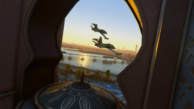
As this is the largest airport in the two volumes it is fitting to look at it first. Daniel Louvet’s version is a vast improvement on the default FSX version. From the St John’s Airport site we learn that CYYT is less than 10 km from downtown St John’s. It is the most easterly airport in North America (Latitude: 47 34’N, Longitude: 52 41’W), and the “flat earth society” calls it one of the four corners of the world!! There are 3 major runways, in 2008 there were nearly 40,000 traffic movements, carrying around 1.2 million passengers. All runways are lit; the longest Rwy 11/29 is 8502’ long at an elevation of 461’. The terminal building was remodelled in 2003. Surprisingly neither the default nor Short Fields X (SFX) version depicts the shape of the terminal building accurately, nor do they model the large car-park in front of the terminal. The SFX version features many of the various buildings that are at the real airport; they are well lit at night, and appear in the correct locations. There are also quite a few “AI” planes parked around the buildings and aircraft ramps. The Air-Bridges (Jet ways) are well modelled and functional in the SFX version. In the SFX version there are a lot of hot air balloons floating with numerous birds flying about, and they could represent a traffic hazard!! Other areas of interest include parking spots for planes, cargo areas, trucks, cars, people, animals, etc. It took me awhile to find the de-icing area at CYYT — very useful. On the whole a nice representation of St John’s, with excellent night textures.
 Figure 3 St John’s Intnl CYYT Courtesy NASA & Wikipedia
 Figure 4 FSX Original CYYT Top Down
 Figure 5 VFR-SFX St John’s CYYT
 Figure 6 St John’s CYYT Courtesy Google Earth
 Figure 7 VFR-SFX View Terminal building
 Figure 8 Air Bridges/ Jet ways General View
 Figure 9 B737 Air Bridge engaged
 Figure 10 CYYT General view and balloons
 Figure 11 CYYT Outbuildings
 Figure 12 CYYT General aerial view
 Figure 13 Outbuildings and AI
 Figure 14 CYYT Gas Time
 Figure 15 CYYT Night-time
Bell Island CCV4
This is a small paved airfield with no services, and a lovely quote from Wikimapia, “Model Airplanes and drag racers often using runway”. Thank goodness, I didn’t see any as I landed in the Cub! It is quite close to St John’s being 20 minutes away by Ferry plus 20 minutes by road and 10 minutes by air. The population is less than 3,000 and seems to be falling. There is a single paved runway, 8/26, 2,300’ long at an elevation of 150’. There the usual add-ons in vehicles, people and animals. Nice modelling from VFR SFX, with very realistic night textures.
 Figure 16 CCV4 The Real Deal courtesy NASA and Wikipedia
 Figure 17 VFR SFX CCV4 Version
 Figure 18 CCV4 Top Down Close-Up
 Figure 19 CCV4 Night-time
 Figure 20 Out Buildings Daylight
Harbour Grace CHG2
Harbour Grace is 100 km from St John’s, it has a population of approximately 3,000, and its main industry is fishing. . The Airstrip dates back to 1919 and is a grass strip, 2,000’ long at an elevation of 325’; it was fully restored after years of neglect in 1999. Amelia Earhart departed on her transatlantic flight from Harbour Grace in 1932. The strip is well modelled by VFR SFX. This must be the glider centre of Newfoundland. The numerous add-ons including AI planes, add to the realism of the airfield.
 Figure 21 CHG2 Real world Courtesy Google Earth
 Figure 22 CHG2 VFR SFX Top Down View
 Figure 23 The Hangar
 Figure 24 Aerial View Gliders
 Figure 25 CHG2 Outbuildings
 Figure 26 Parking and Buildings
Stephenville CYJT
Located on the West Coast of the Island with a population of 8,000 and the principal industries are farming, fishing and tourism. The airport was originally a US Air Force Base, being fully civilian operated from 1966. It has two runways, the major runway is paved and lit – 09/27. It is 10,000’ long which is the longest runway in Newfoundland. It is about one hour’s flying time from St John’s. Nice modelling, great buildings and the bears werefascinating.
 Figure 27 CYJT FSX Default Top Down
 Figure 28 VFR SFX CYJT Top Down
 Figure 29 Aerial View LEFT
 Figure 30 Aerial View RIGHT
 Figure 31 Hangar and Bears
 Figure 32 Gas and Tower CYJT
 Figure 33 Parking CYJT
Deer Lake CYDF
Deer Lake is situated on the west Coast of Newfoundland, it has a population of around 5,000 and the main industries are tourism, farming and paper. The paved and lit airport was built in 1955; there is a single runway, 07/25 being 6,000’ long with an elevation of 72’. Again the buildings, vehicles and other add-ons add to the experience.
 Figure 34 CYDF Deer Lake Courtesy NASA and Wikipedia
 Figure 35 VFR SFX CYDF Top Down
 Figure 36 CYDF Parking and AI Helicopter
 Figure 36 CYDF Parking and AI Helicopter
 Figure 38 CYDF Aerial Top down View
St Anthony CYAY
St Anthony is situated on the Great Northern Peninsula and has a population base of 3,100 people and a regional population of 25,000. The main industries are tourism and fishing. The Airport has a single runway, 10/28 being 4,000’ long with an elevation of 108’. Good AI, piles of, lumber, vehicles and buildings add to the simming experience.
 Figure 39 FSX Original CYAY Top Down
 Figure 40 VFR SFX CYAY Top Down View
 Figure 41 CYAY Aerial View
 Figure 42 CYAY Top-Down View Close Up
 Figure 43 CYAY Parking 1
 Figure 44 CYAY Parking 2
 Figure 45 Parking 3
 Figure 46 CYAY Tower View
Sounds
None that I heard..
Summing Up
These two volumes of 6 airfields are really quite good add-ons for FSX. They enhance the default scenery and make it much more interesting to fly in this geographically beautiful area. I would have liked to have seen more detail at St John’s, but for the price they represent good value. There were no issues at any of the 6 with respect to take-offs and landings. I’m looking forward to seeing the next volume with Gander (hopefully) included. I didn’t really fully test IFR landings as they are a VFR series, but I doubt that there would be any issues. On one IFR approach into St John’s using the default 737, ATC and the Navaids were spot on and I managed quite a good instrument approach and landing in very rainy weather.
WOW Factor: 8 out of 10.
Peter Hayes
Australia
December 2009
Table of the Important Bits:
| Publisher: | VFR-Short Fields X |
| Supplier: | Simmarket by direct download. http://secure.simmarket.com/vfr-short-fields-x-volume-1-newfoundland.phtml http://secure.simmarket.com/vfr-short-fields-x-volume-2-newfoundland.phtml |
| Download File Size: |
Exe File Vol 1: 13 MB; Vol 2: 11MB |
| Installed File Size: | N/A (few KB for the bgl files plus up to 25MB for charts, pictures and manuals |
| Simulator Requirement: | FSX with SP2 (or Acceleration) |
| OS Requirements: | Win XP, Vista and/or Win 7; |
| Testing System: | Intel E8600, 4GB DDR 800 RAM, Vista 64 SP2, nVidia 9800 GT, 182.50 Driver; FSX SP1 + SP2; 750GB SATA II Seagate 7200 HDD. No Tweaks all standard and no over-clocking. |
| Scenery: | FSX Default; FS Genesis, UTX USA/Canada; GEXn; X-Graphics. |
| Installation: | Installation is simplicity itself being automatic via a self extracting exe file. Should be installed with Admin rights — VISTA right click “Run as administrator”. |
| Manuals / Documentation | Two manuals covering each volume. |
| Support: | support.shortfieldsx@gmail.comBy email excellent support by return |
| Forum: | N/A |
| Updates | N/A |