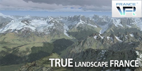
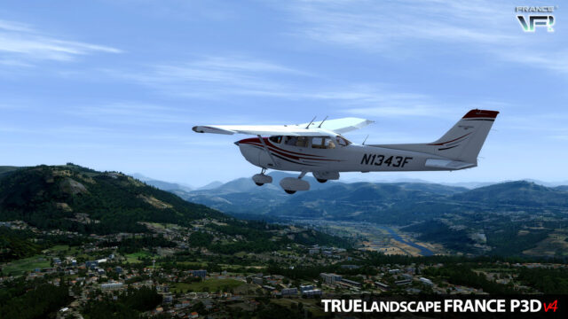
« TRUElandscape – FRANCE » is an addon for Lockheed Martin® Prepar3D® that covers the entire French territory with a brand new landclass and landscape scenery providing a better rendition of the land cover and the finest hydrographic network designed to bring the best experience in VFR flying.
The ambition of this product is to provide a true benchmark for VFR simulated air navigation. We will soon set up a monitoring and reporting that will allow to regularly specify, modify existing data and enhance the product.

TECHNICAL SPECIFICATIONS:
– New definition for whole coastlines and hyrographic system.
– Reassignment of all landclass covering France and Corsica.
– Redefinition of urban, industrial, commercial and harbor areas…
– Redefinition of fragmented deciduous, mixed, coniferous and young forests…
– New qualification for all coastlines, sandy, beaches, dunes, rocks and heaths…
– Pylons for high voltage and very high voltage power network over the country.
– Many photoreal areas (mountains, snow, glaciers, vines, dams, sans quarries…).
– Product installation does not modify any files from your Lockheed Martin® Prepar3D®, neither any previously installed add-on.
– Product can enabled or disabled with a simple click in the scenery library.
– All data is geo-referenced to ensure compatibility with any other georeferenced product.
“TRUElandscape – FRANCE” is compatible with all types of addons (including OrBx products LC and Vectors), such as landclass or photo sceneries. It must be set in the scenery library over “landclass” sceneries and below photo sceneries and smaller local sceneries such as airports.