

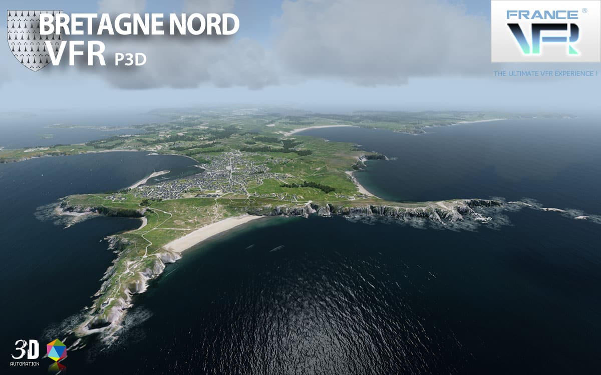
 The western region of France named Bretagne is a nice place to demonstrate the power and realism displayed in your P3D simulator because the shorelines are particularly scenic with cliffs, small ports and coastal villages, natural beaches..
FranceVFR use high definition ground textures (0.8 to 1.20m per pixel) made of aerial pictures combined with specific and dense Autogen, placed with accuracy to depict the typical region style.
This 3D photoreal huge photoreal scenery modelizes the whole French Britany region.
The new VFR Regional Extension Pack series was designed and developped to provide VFR flight an environment as realistic as possible. It is the result of years of experience and practice in flight simulation and 3D modeling.
“VFR Regional” products embed all enhancements from the new 3DAutomation® technology developed by France VFR. This technology already allows to generate the most realistic and dense environments ever seen. It does not intend to model real world accurately but to create a copy “as real as it gets” on a massive scale. It will evolve to adapt to the needs and new data available.
TECHNICAL SPECIFICATIONS:
– Ground textures from 0.8 to 1.20 meter / pixel resolution from IGN aerial photography reworked for an optimal visual rendition in Prepar3D® (summer only).
– Dedicated mesh with high definition 4.75 meters (LOD13).
– Lakes and rivers with navigable waters fitting the texture.
– Transparency management of the seabed on the entire scene.
– Semi-detailed generic airports including flatten platform correction.
– Obstacles and VFR landmarks modeled on the entire scene including the official SIA database (antennas, towers, water towers, wind turbines, various constructions …).
– Hundreds of thousands of objects and notable buildings integrated into the environment (churches, power plants, silos, castles, industrial tanks, bridges, tolls, cranes, boats, streetlights, road signs …).
– Integration of 3D Automation® technology allowing multi-million buildings and realistic vegetation areas fitting geographic specs.
– Extremely dense and optimized vegetation coverage using a custom rendering module controlled by artificial intelligence (AI).
– Autogen buildings including additional specific and optimized 3D variations.
– Geo-referenced data for maximum compatibility with future add-ons installed on the same area.
– Development process 100% Lockheed Martin® SDK specifications compliant, ensuring maximum compatibility with new releases.


