

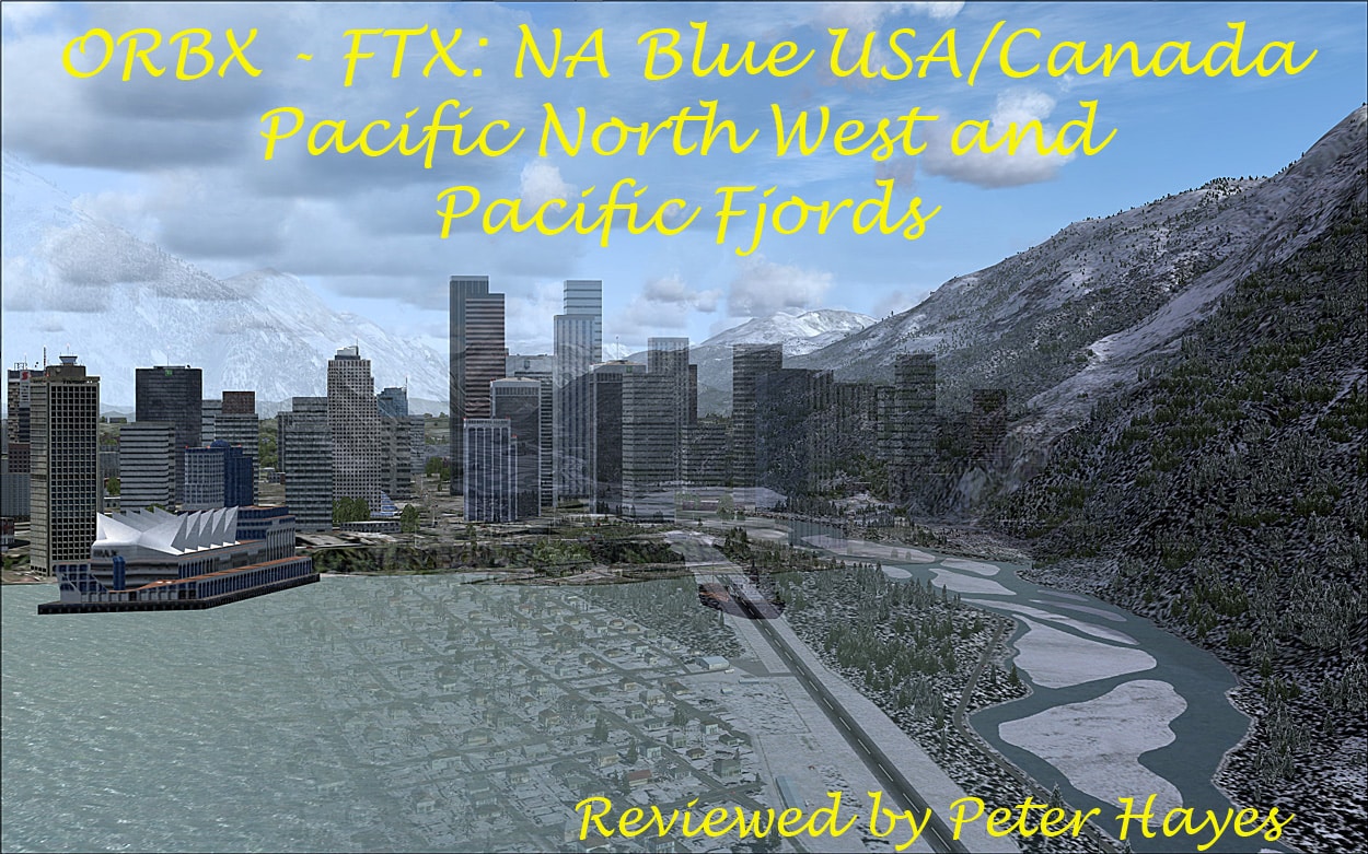
Pacific North West and Pacific Fjords – The Strait or Norwegian Inlet Review.
Quick Summary: Orbx FTX following on from the success of producing a high quality scenery products for Australia are now producing high quality scenery for the USA/Canada and these two titles are the first in the series and nicely abut (seamlessly) to Holger Sandmann’s Tongass Fjords. There is now a third title in the series, ‘The Northern Rocky Mountains’, which I hope to review at a later date. Because of the vastness of the area covered and I am combining two exquisite titles together into a single review, but do understand that this review can only skim the surface of this beautifully engineered part of our sim world. As in Tongass FSX these two areas depict faithfully and beautifully the diverse environment found there such as, the coastal temperate rain forests, glacial fjords, vast forests and tundra meadows, all in vivid detail, and like Tongass this is a must have for any GA pilot that likes to fly low ‘n slow. All of these areas fit seamlessly together so now we can fly in a huge part of the North Western part of the USA and Canada. These packages show what can be achieved in FSX.Installation:
The installation is covered in the user guides and you fill in the order #, date and key and just let the “exe” file do its thing and everything is automatic. On completion of installation FTX central pops up, and this runs the file management routines necessary for all of the FTX products. To fly in the region you need to select the ‘North America’ region to use the appropriate texture files, etc.   The usage of FTX central is again well discussed in the user guides. Installing from a DVD is covered by a separate procedure.

Background: See PNW/PF user guides and Wikipedia:
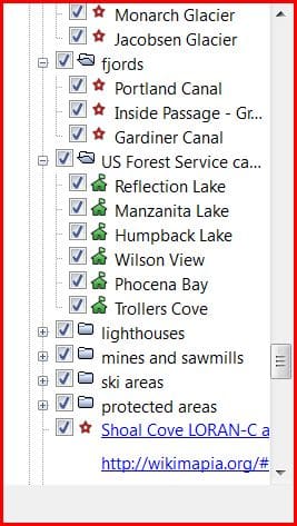
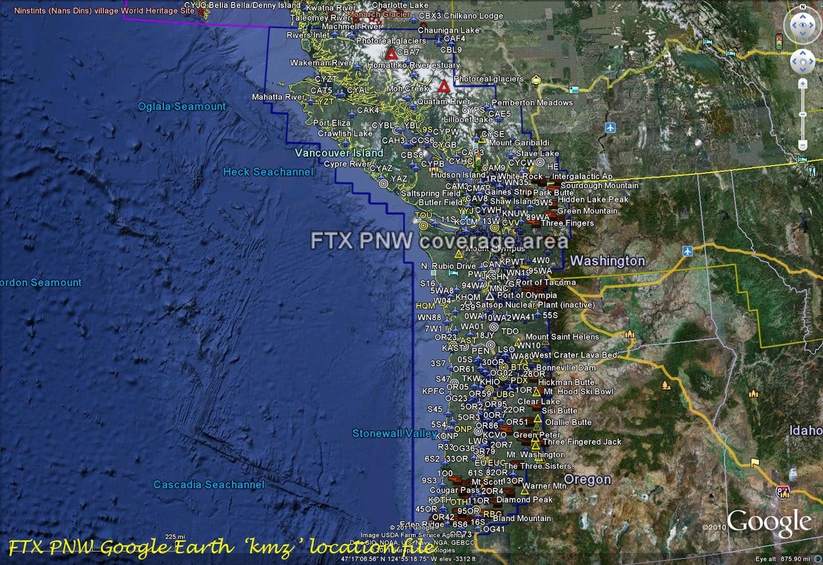
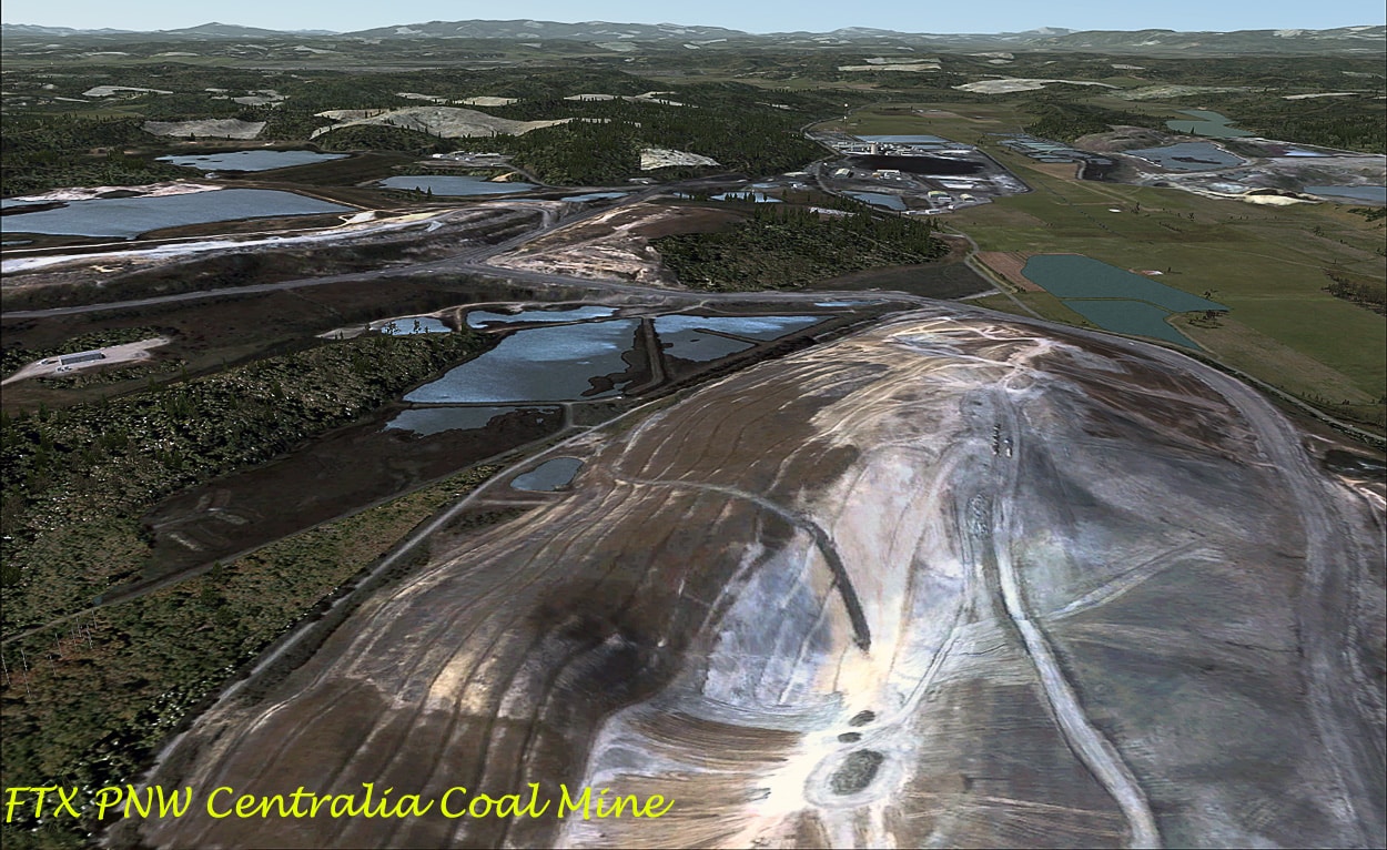
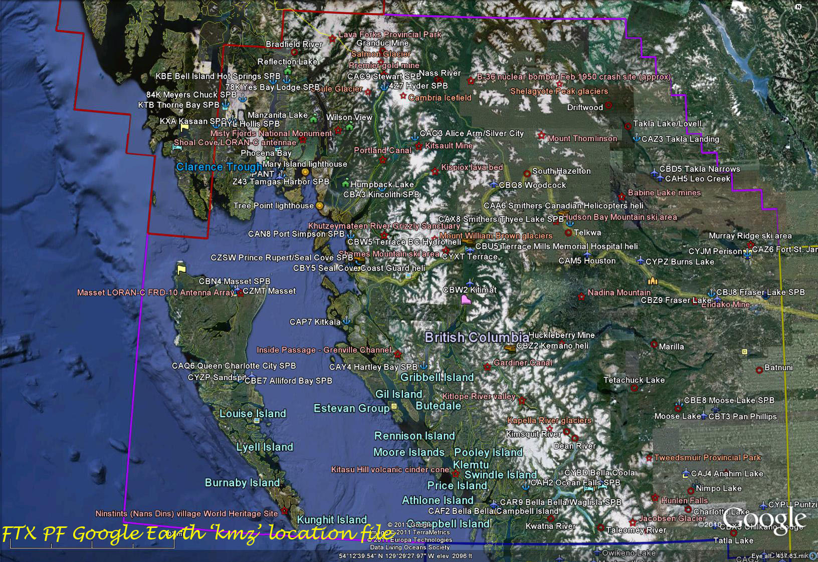
This detail of the two areas is very well covered in the user guides, so will not be repeated here in detail, just a few background facts. The combined areas cover a total of ≈280,000 square miles, including parts of British Columbia, Southern Alaska, Oregon and Washington. Supplied with each area is a Google Earth ‘kmz’ file which shows the location of all the airports, airfields, seaplane bases and helipads. OG41 Nace Family Airstrip seems to be the southernmost strip covered with Hyder or Reflection Lake SPB’s being the most northern ‘strips’ depicted. There are also numerous points of interest, in the GE sub-menus and usually depicted as red stars or triangles dotted throughout the KMZ, including fjords, glaciers, canals, extinct volcanoes, ski areas, sawmills, lava beds, mines and the odd crash site. The two packages cover ≈ 600 landing areas for planes/helicopters from international aerodromes, medium size airports, grass landing strips, seaplane bases and heliports/pads. The vast majority of airfields are in the PNW scenery with over 450 being depicted. The scenery packages also cover the metropolitan areas found in the region plus the vast valleys, ice fields/glaciers, mountains, islands, craggy inlets, fjords, seaways, canals, forests, roads, tracks, ports, lakes, rivers and even down to the diminutive ponds.
The General Areas:
The Pacific North West:
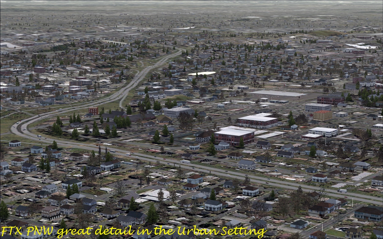
Wikipedia states that: ‘The Pacific Northwest is a region in western North America, bound by the Pacific Ocean to the west.  A general description for PNW states that it includes Oregon and Washington, and British Columbia but this is often restricted further to include just the coastal areas.’ About 10 million people live in this vast wilderness. The major cities e.g. Vancouver, Portland, Seattle and Tacoma, all began as seaports to support the logging, mining, and farming industries of the region. Latterly they have embraced the latest technologies (Silicon Forest, Aircraft construction), thus diversifying and they benefit from their location on the Pacific Rim.
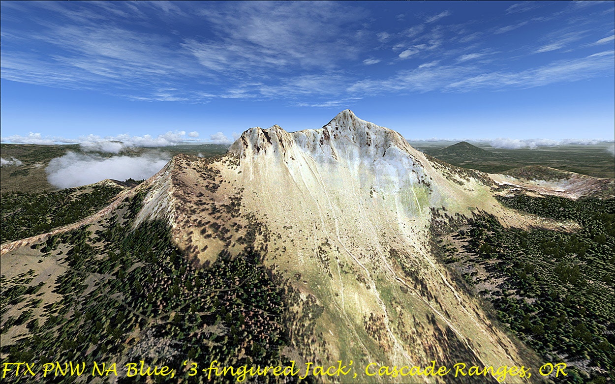
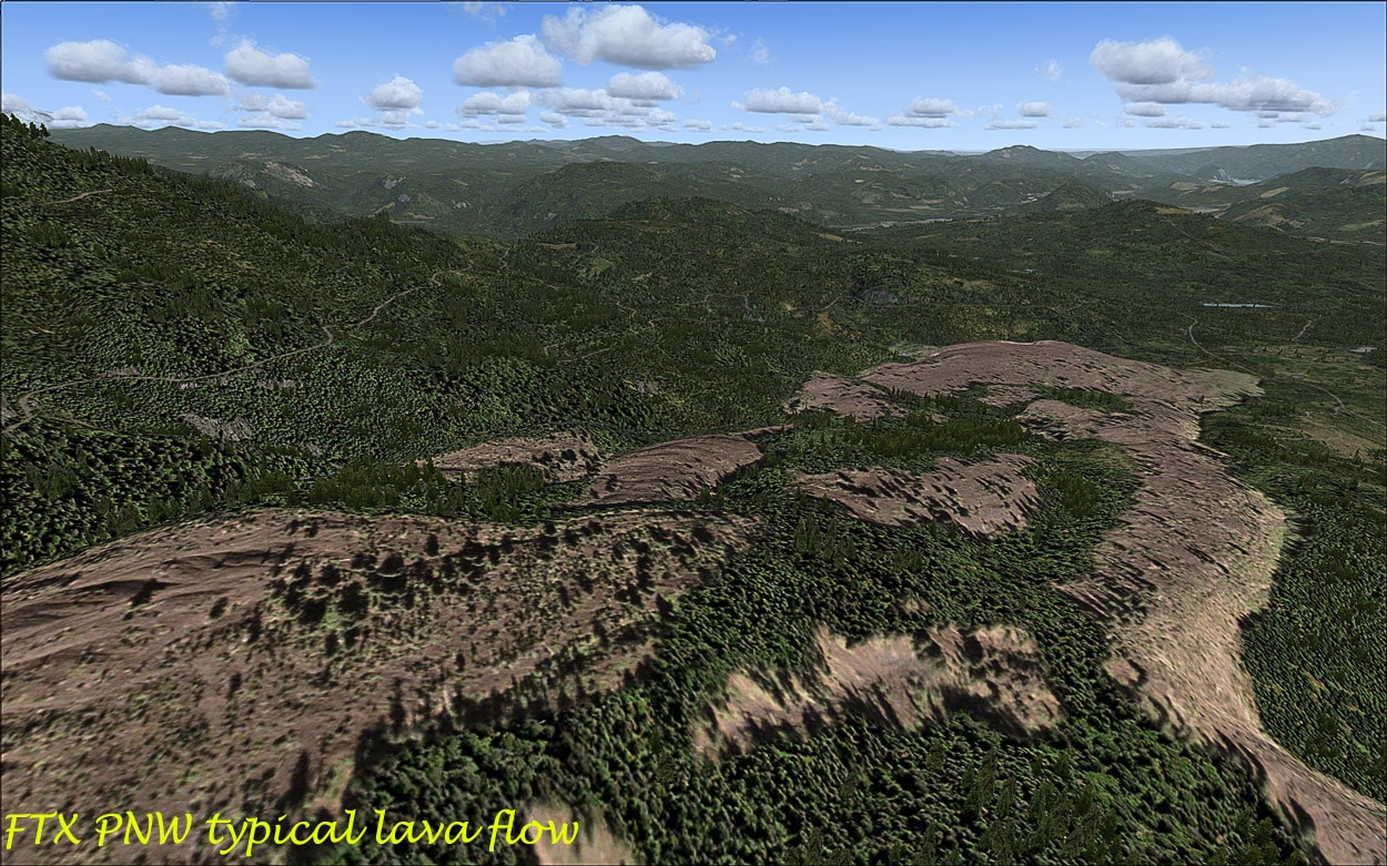
The region has several US and Canadian National Parks, including Crater Lake in Oregon, and Olympic, Mount Rainier, North Cascades in Washington, Pacific Rim National Park in Vancouver, Mount Revelstoke National Park and Glacier National Park in the Selkirk Range alongside Rogers Pass, as well as Kootenay National Park and Yoho National Park on the flank of the Rockies. The FTX PNW reproduces that area in vivid detail and stunning accuracy.

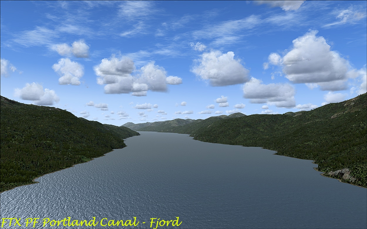
Pacific Fjords:
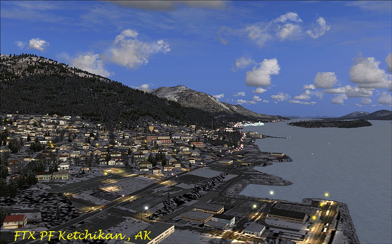
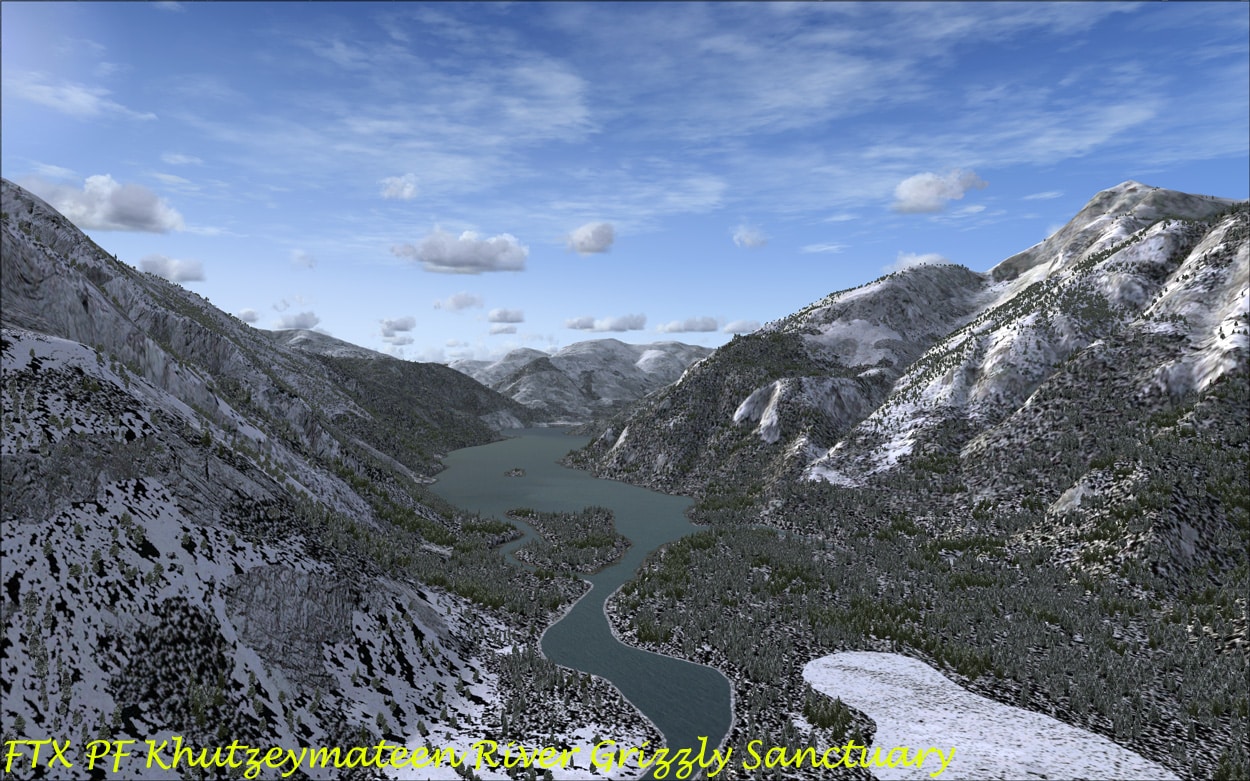
The major portion of this scenery is devoted to Misty Fjords National Monument which is designated a protected area administered by the US Forest Service on the Pacific Ocean coast of North America, in SE Alaska. The major city in the area is Ketchikan. Of course, the ORBX/FTX scenery covers the area south to Vancouver Island including Bella Bella, Bella Coola, the main archipelagos of Prince of Wales Island, and the Queen Charlotte Islands, the BC hinterland and the numerous fjords and glaciers found in this area. The main economies include art, tourism, logging and commercial fishing. Again a diverse temperate area faithfully reproduced by the ORBX/FTX team.
The User Guides:
Both are 26pp long and cover all of the basics about the scenery from installation to optimum settings in FSX. They are very well laid out and easy to read and should be kept handy as a reference to get the best out of the scenery. There are sections on computability with other 3rd party add-ons and these should be consulted so that you get the best visual experience. The section on FTX Central is excellent and using this you can customize most of the ORBX/FTX products as well as witching back to your original FSX settings prior to installing the ORBX/FTX series.
The Weather:
This is an important of these two packages as this is vast temperate area with coolish temperatures and high rainfall. Included are some custom ORBX weather themes which virtually ‘replace’ real world/time weather and provide a ‘broody, moody weatherscape that real pilots revel in!’ There are 6 of these (1 -4 were used in FTX Australia) and they are all excellent particularly 5 and 6 for this region with number 5 being the real challenge. Here are a couple of weather scenes taken around PAKT, one reasonably fine and one stormy and broody.


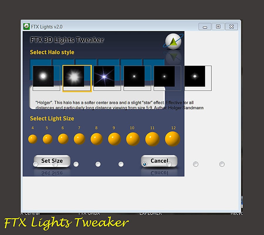
The 3D lighting system:
Orbx has developed its own exclusive lighting system for all roads in urban areas and major roads in cities. Included is a FTX Lights ‘tweaker’ which enables you to select which ‘Halo’ style and light size that you prefer in FSX. By default the lights are set to REX1 halo and size 11, and I found that these were the best settings on my rig.
In the Sim:
Settings: Â I used the settings as recommended in the user guides and with these using a ‘best balance’ setting, I did not see any significant frame rate hit and there was a smooth experience throughout the review.
The Visual Splendour:
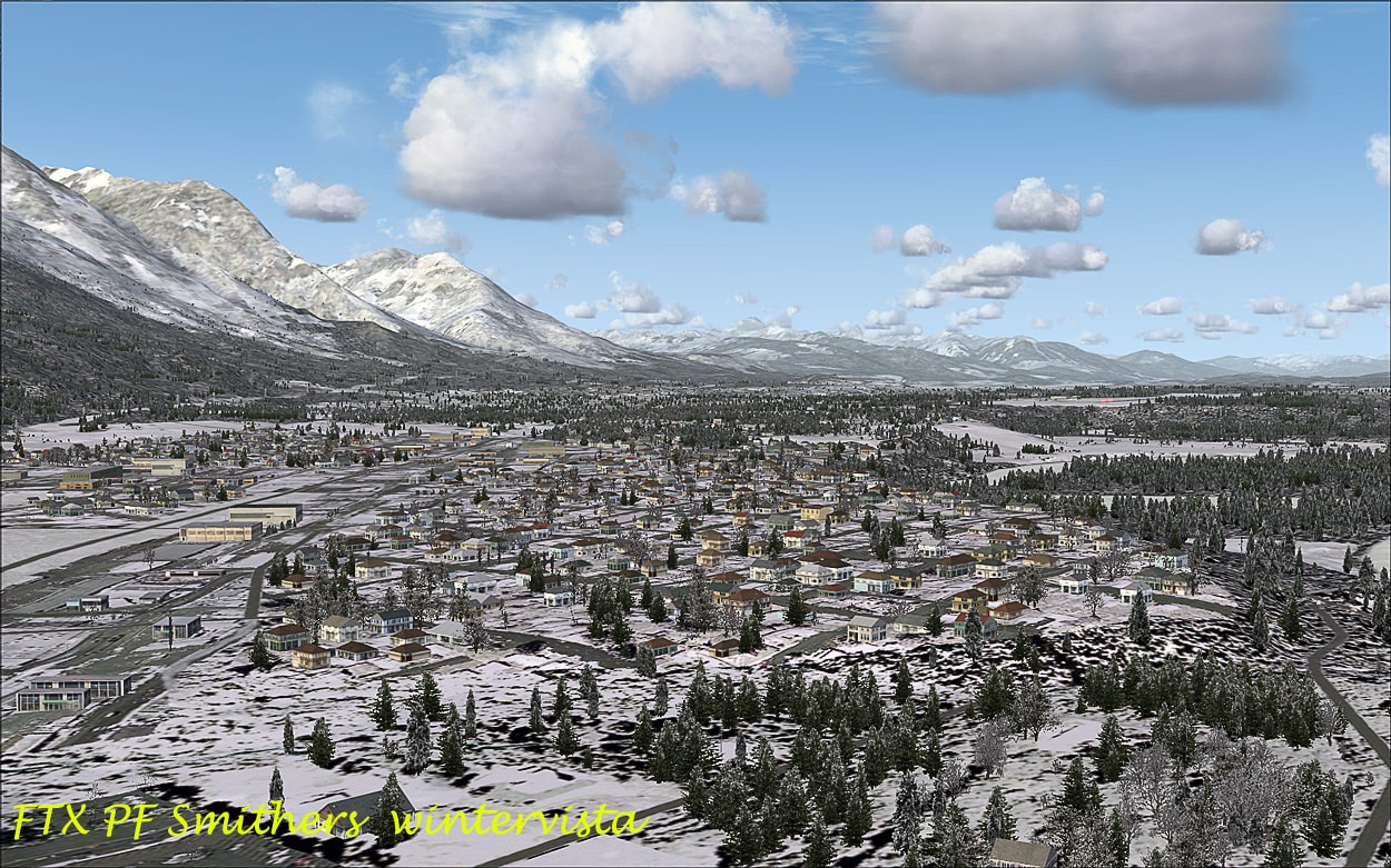
The default FSX scenery is again only reasonable in this area, landclass/textures from 3rd party suppliers such as FS Global, FS Genesis, FScene, etc., together with enhancements such as UTX and GEXn help quite a lot, but PNW/PF just transforms it into a reality-like experience. Those dreadful default straight angular coastlines are gone and they now resemble what you would see in the real world, much more natural in appearance. The mountains, forests, glaciers seas, rivers (serpentine like), fjords and inlets are just breathtaking, they look so real and you can almost feel the cold as you fly there on winter’s day! Brrrr . . . The colours are outstanding and change with the seasons or the weather. The airfields are just great and nirvana for me flying small GA planes under VFR.

The Cabins:
The cabins seemed almost to have disappeared with 6 only being included (BooHoo), but the good news is that 40 of the local US Forest Service cabins are to be included in the next update/service pack. Plus, just recently Misty Moorings has returned as a viable source for other cabins to be added to the area. On the ‘Return to Misty Moorings‘ site there are over 40 cabins, towers, retreats and hideaways, plus the TRIPTICS, maps, forum, etc. These are great additions for this part of the world, but do note that you may need extra files for the cabins to display properly and you need to close and then re-apply FTX central/FSX before you install these add-on cabins. The current FTX cabins are pretty basic but the SP should include new custom models by Bill Womack.
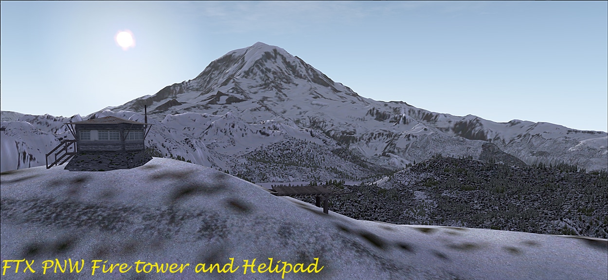
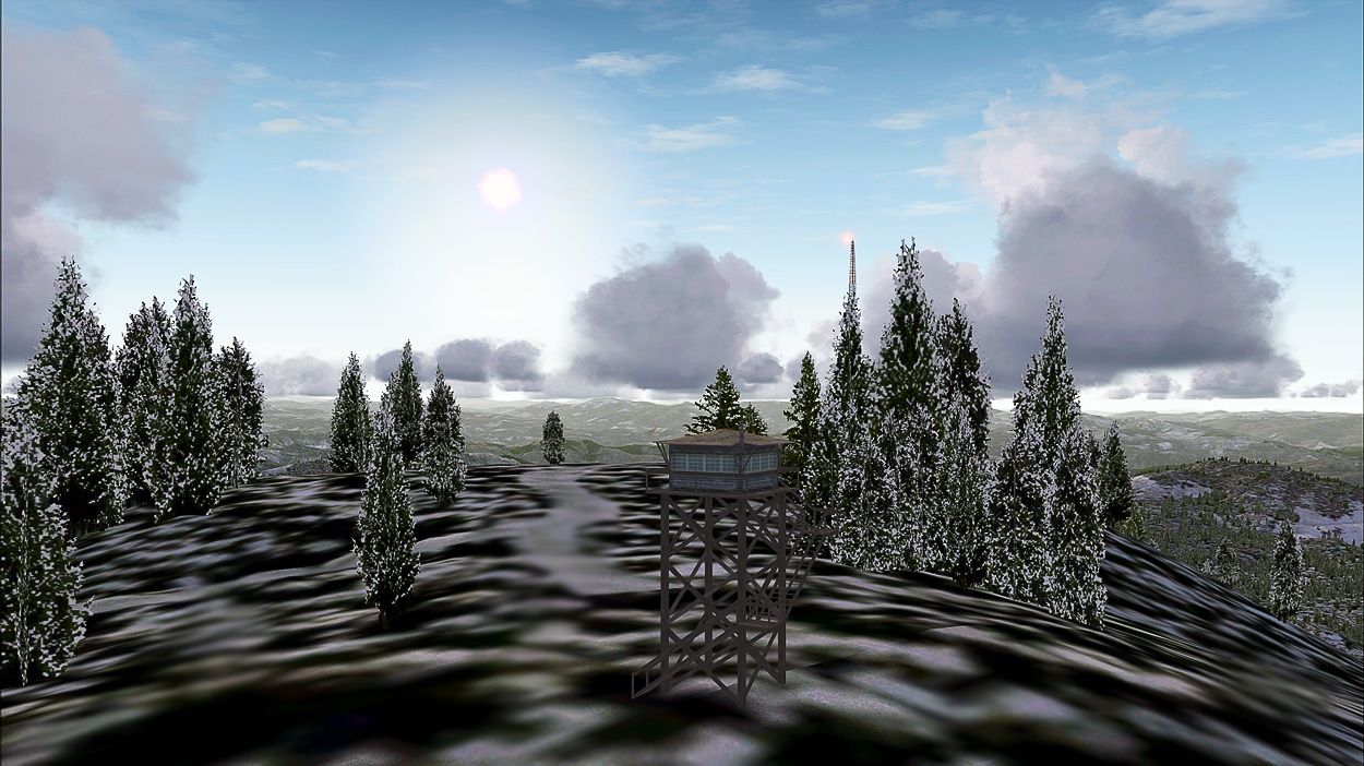
I couldn’t find any cabins in the Pacific North West area, but as Holger Sandmann told me, they weren’t modelled as most of the cabins are situated in dense forests/bush and access would be limited to helicopters and that could be tricky if not unrealistic!! Â Â The KMZ is an excellent resource and in PNW I was able to locate the many fire-towers (many with cabin style buildings) and helipads throughout the region.
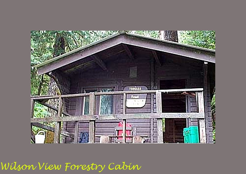
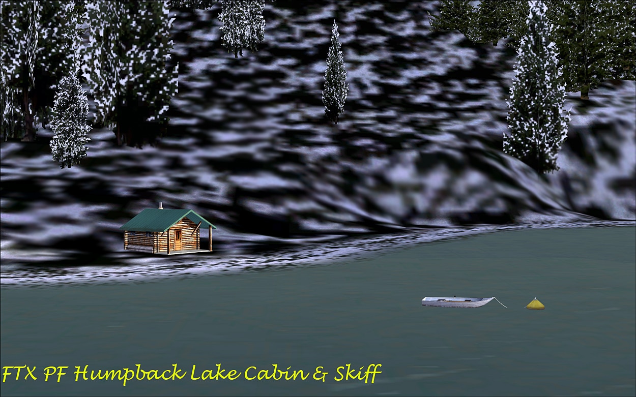
In PF the cabins are not always easy to find, with some being tucked away in the trees but some have got a smoking chimney to guide you closer and Bill Womack has usually moored a skiff to a “bobbing” mooring buoy close by. The cabins that I spotted were at Trollers Cove, Reflection Lake, Manzanita Lake, Phocena Bay, Humpback Lake and Wilson View. I give the references for these at the end of the review
Bill Womack has added his “bobbing buoys” to which there is a skiff moored just out of reach of the cabin it belongs to.
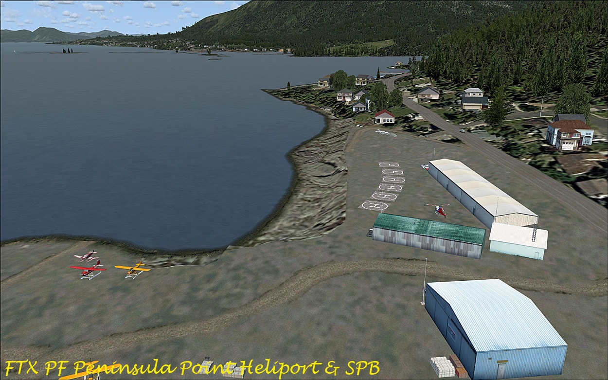
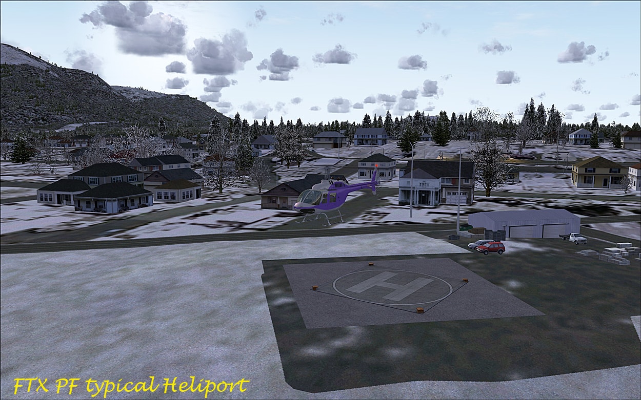
The Helipads/Heliports:
There are several of these dotted throughout PNW and PF  with some of the helipads being pretty basic i.e. being planks of wood — in other words nothing fancy and definitely for VFR flying. You can choose these in FSX as for any other airfield in the database and the KMZ lists all of them including the 40+ helipads in the PNW area plus 10+ Heliports in PF). These are the ultimate challenge and I found trying to land on these even with the default helicopter was well beyond my limited skills.

Areas of Interest:
See kmz
These are all displayed in the kmz and this is the best guide to find the areas of interest which are too numerous to fully discuss here.Â
However briefly:
In PNW we have:
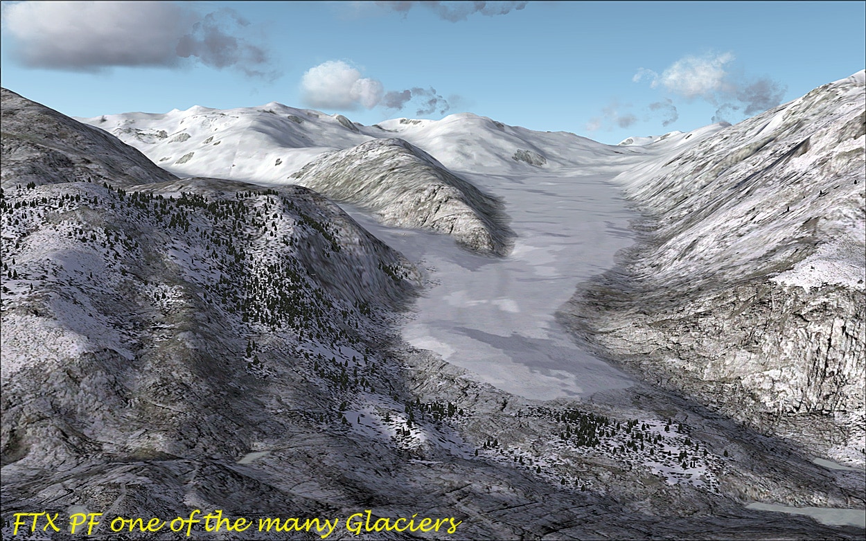
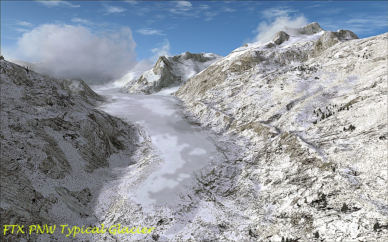
- 400+ Photoreal Glaciers
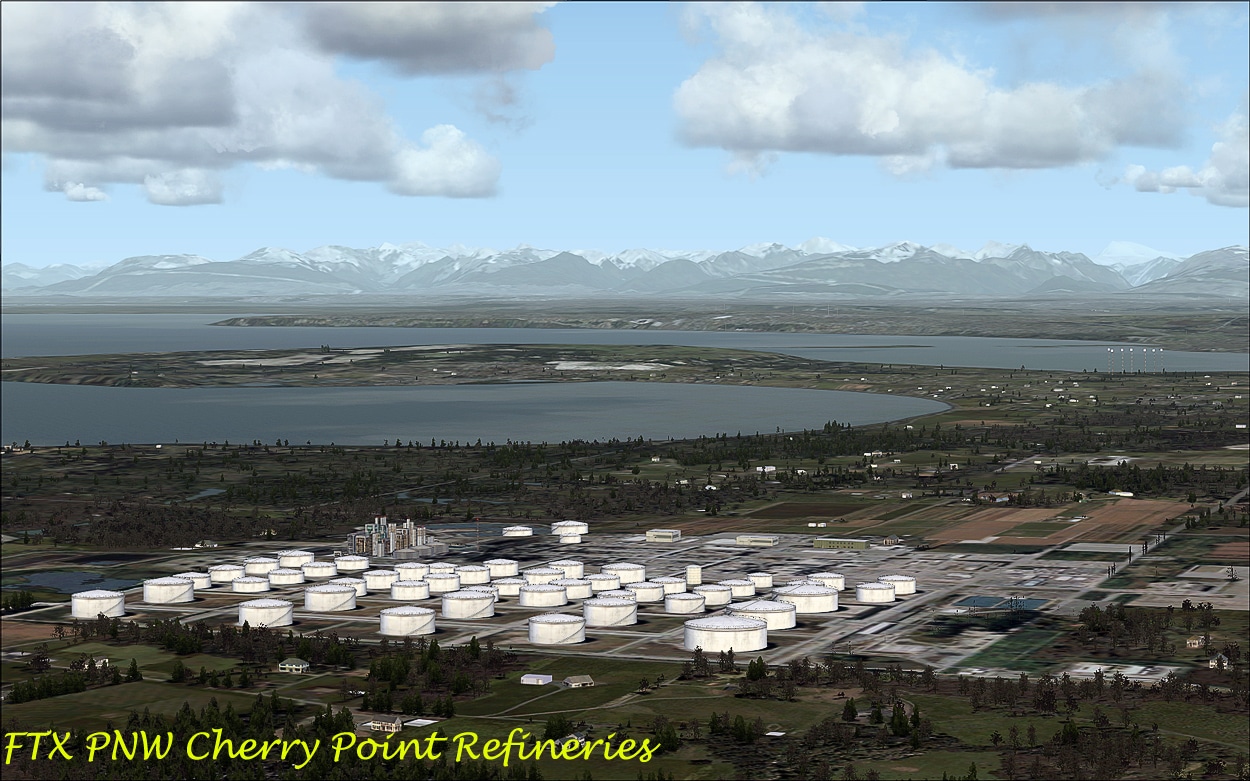
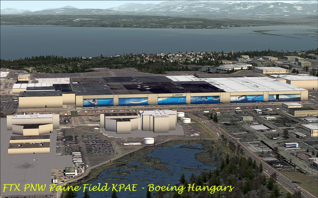
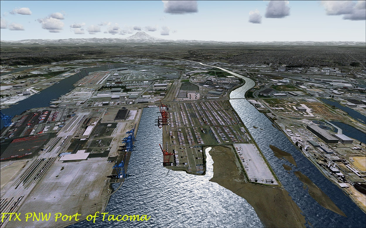
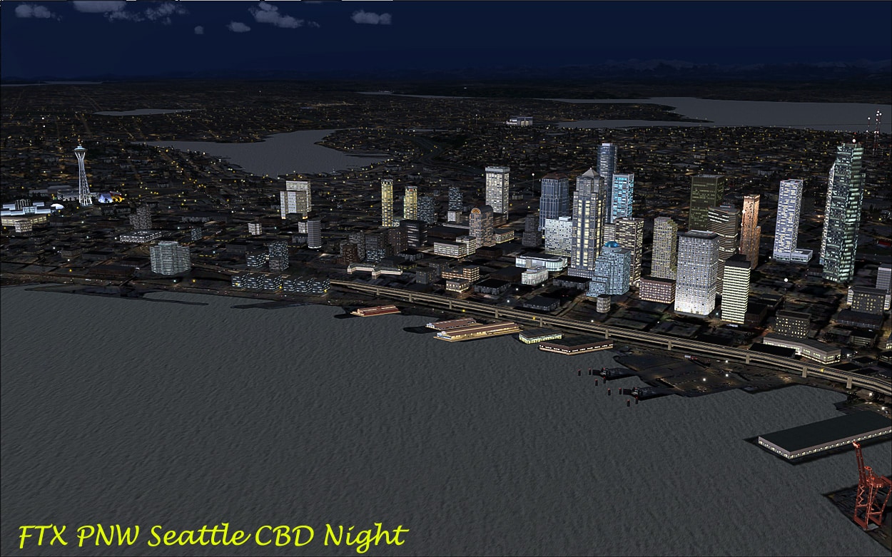
- 8 Photoreal points of Interest, including Tacoma Port, Seattle CBD, etc
- Several Areas in the Cascade Range Volcanic Peaks and lava flows including Mt Rainier Mt Olympus, and Mt St Helens.
- Plus all the airfields, helipads and fire-towers, etc as discussed above.

![]()

In PF we have:
- 8 Glaciers
- 3 Major Fjords
- 6 US Forestry Cabins
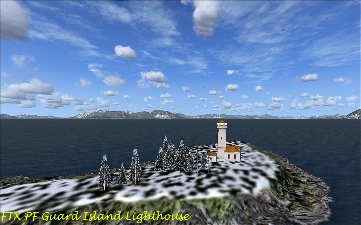
- 3 Lighthouses
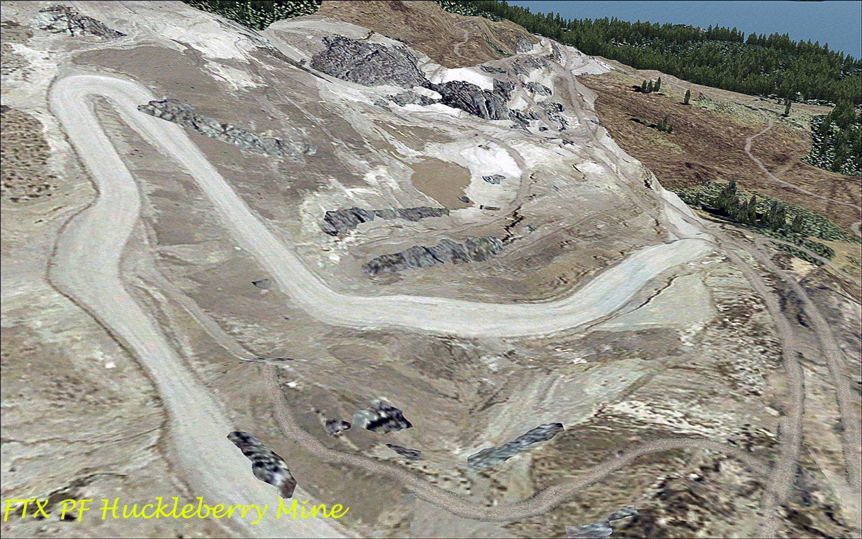
- 6 Mines
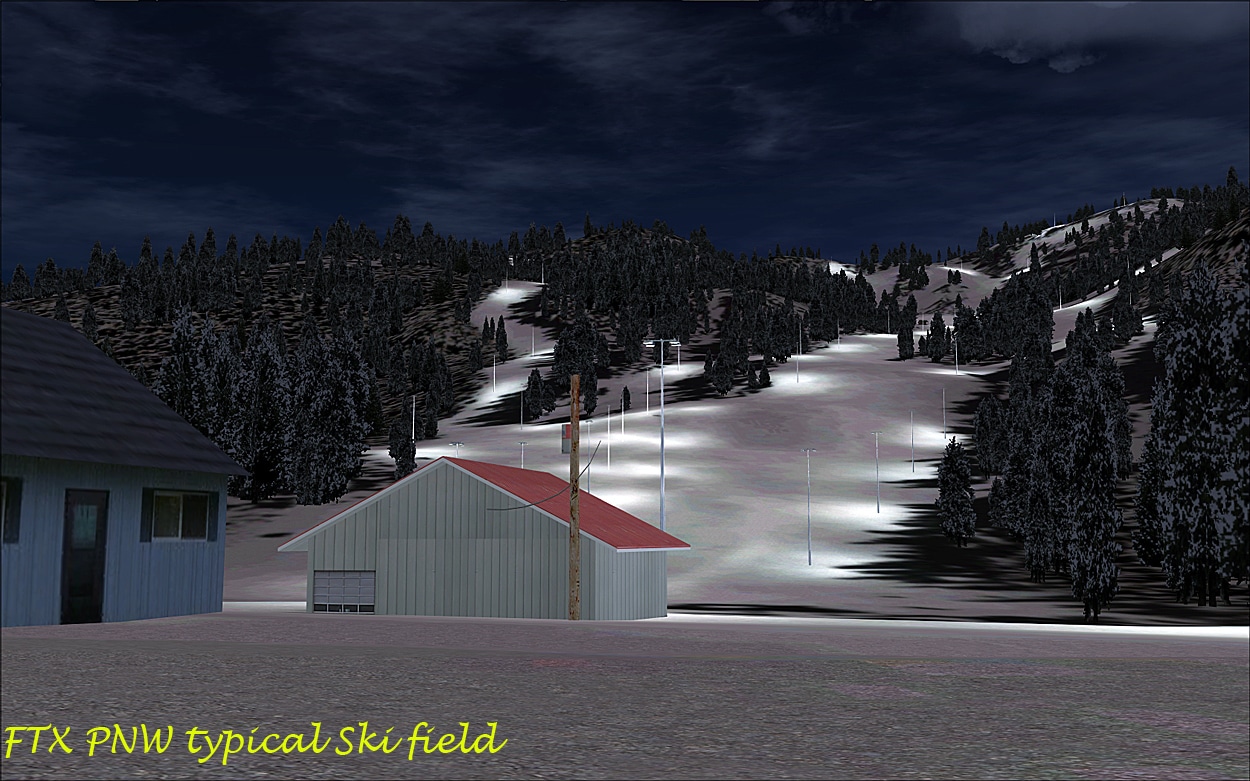
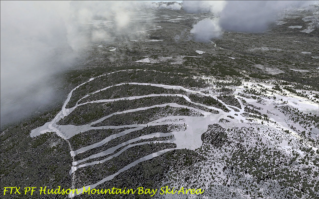
- 3 ski areas
- 5 ‘Protected’ areas
- 3 miscellaneous areas
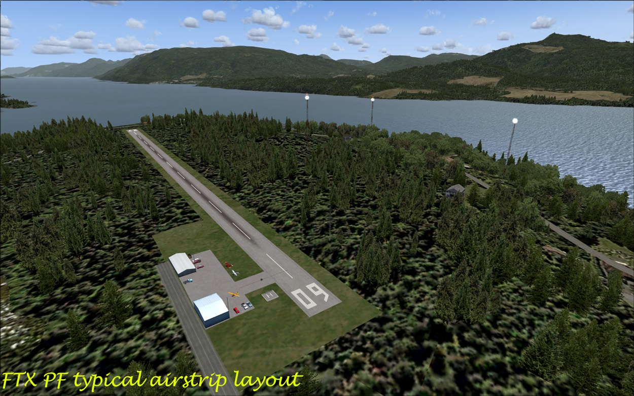
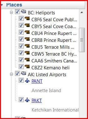
Airfields (Listed and unlisted):
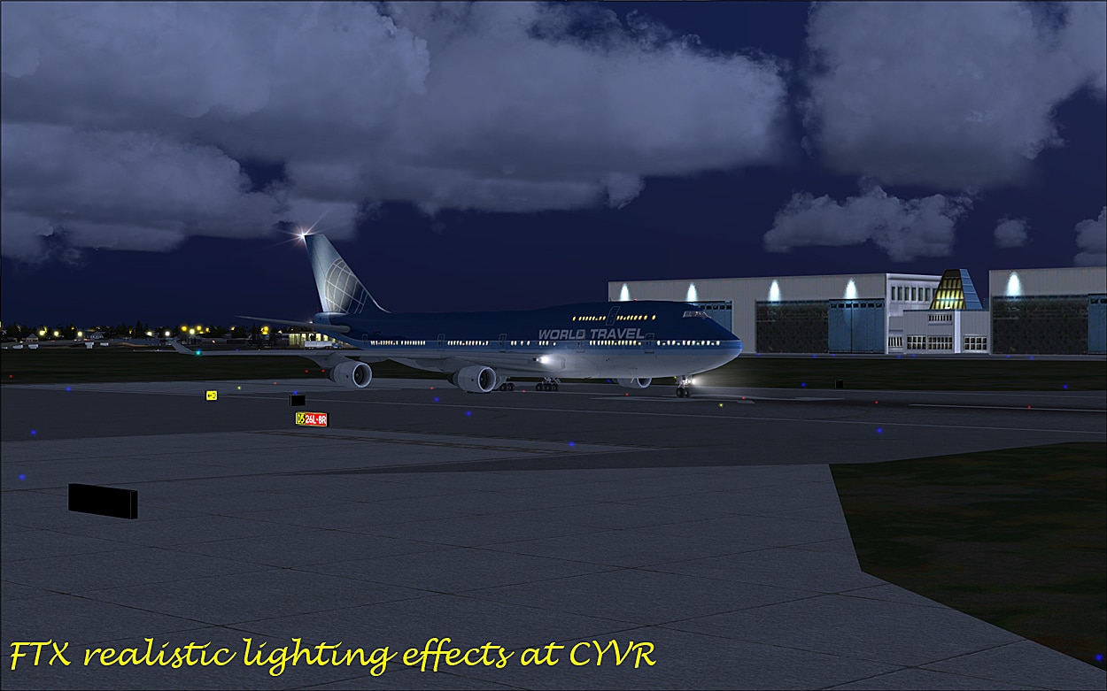
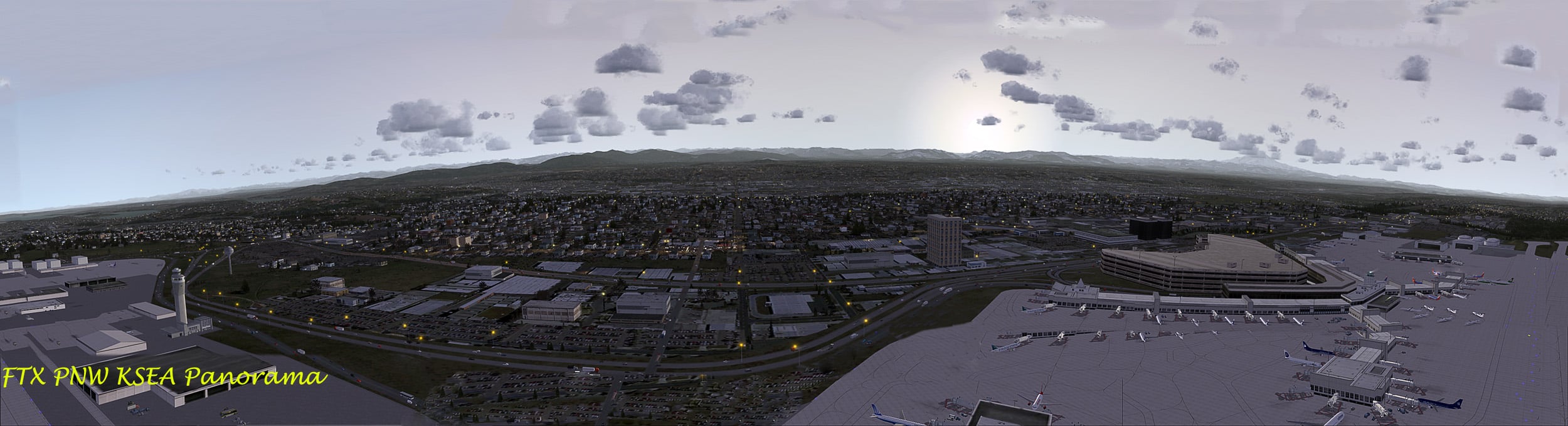
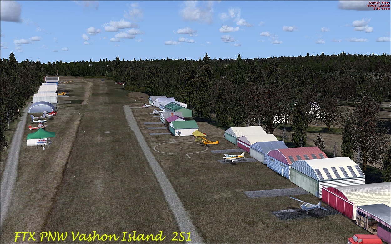
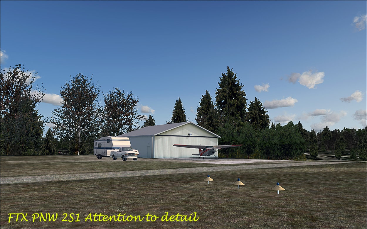
There are well over 400 airfields in the two areas, I could not find all of the unlisted airfields in FSX so I navigated to these using the GPS cordinates. Of note is Vashon Island 2S1 which is available as a free download that fits seamlessly into PNW. (Portland City is to be released soon as freeware.) All of the included airfields are quality add-ons and the larger airports include KSEA, KPDX, CYVR and KPAE. OzX (OzX NA) also supply over 20 airfields for the PNW scenery and these are well worth having full details are available on their website.
 The Ferry Captain was drunk!!
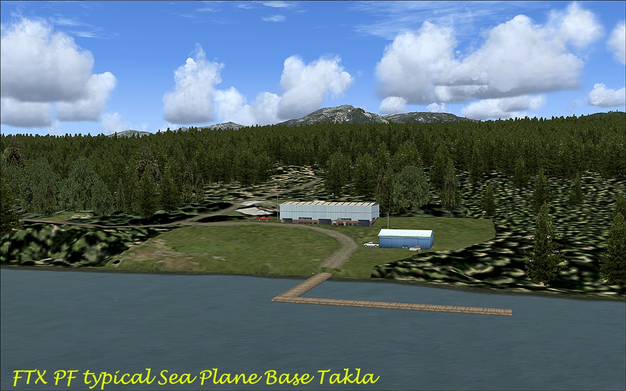
Seaplane bases and floatplane/boat docks:
In PNW there are 30 SPB’s or so in BC and Washington, and 3 SPB’s in Oregon;
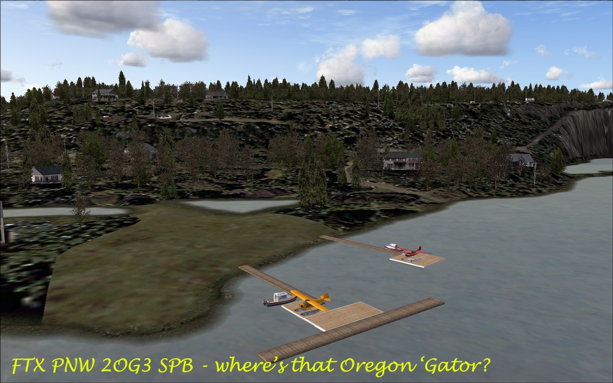
In PF there are 20+ SPB’s in BC and 14 or so in AK. All are well modelled with typical features of a SPB, I visited several including. 2OG3, but failed to spot the ‘Oregon Gator’!
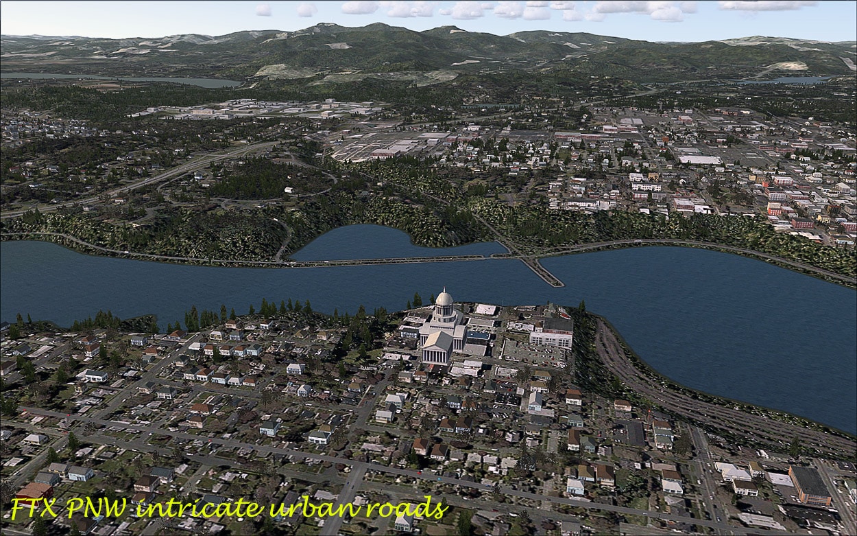
Roads:
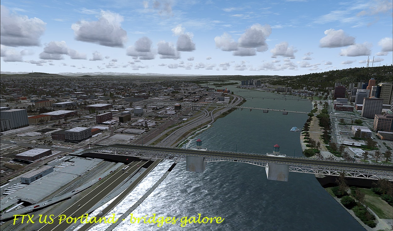
These are excellent and are very useful for VFR navigation. The bridges also look good, and I can’t comment on tunnels as I didn’t find one! The logging roads are also depicted and well represented throughout both areas.
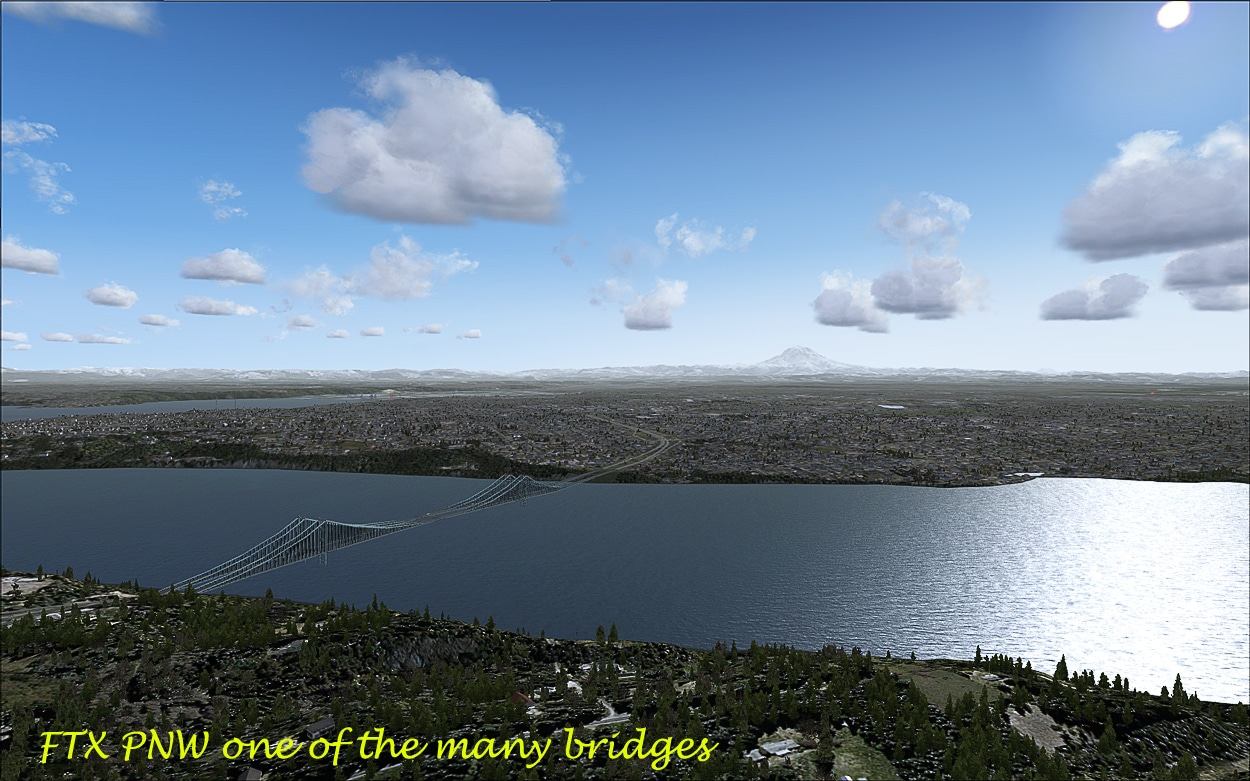 Tacoma Narrows Bridge

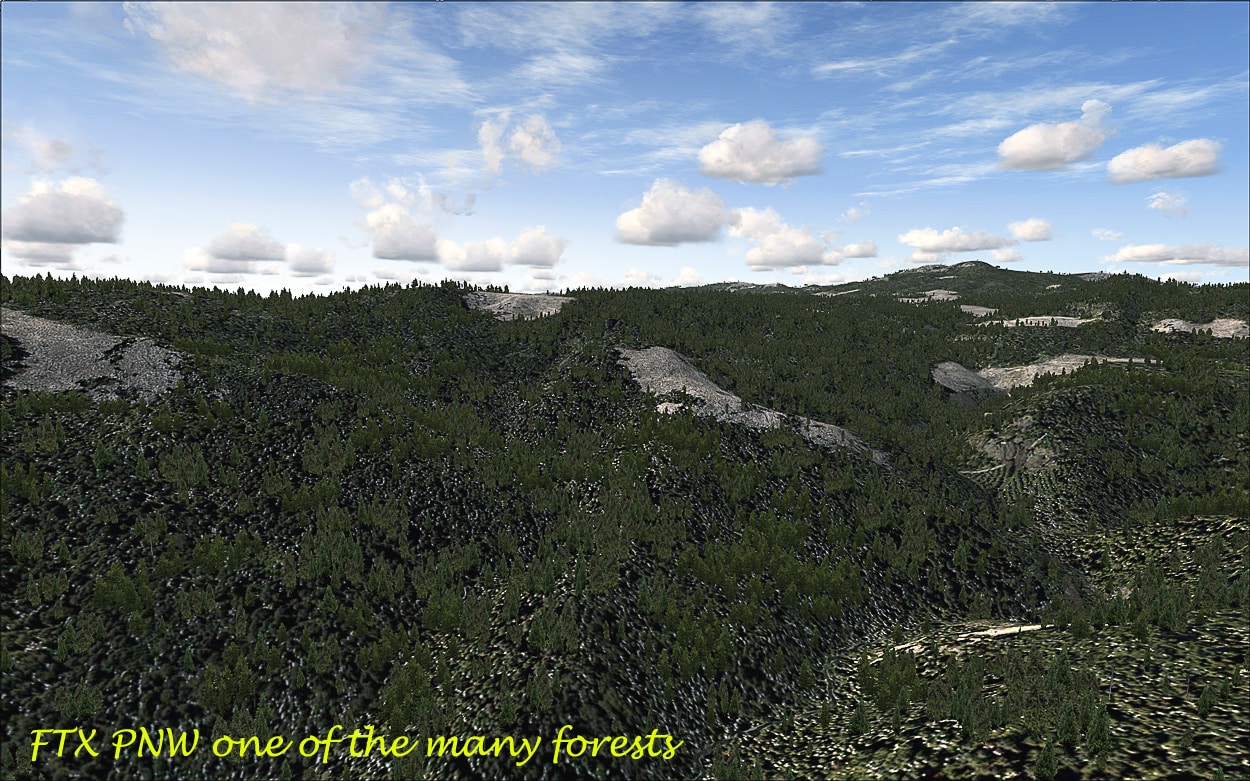
The Forests:
Extremely dense and well represented, and there are “bare” areas too depicting some sort of logging. (see various pictures above)

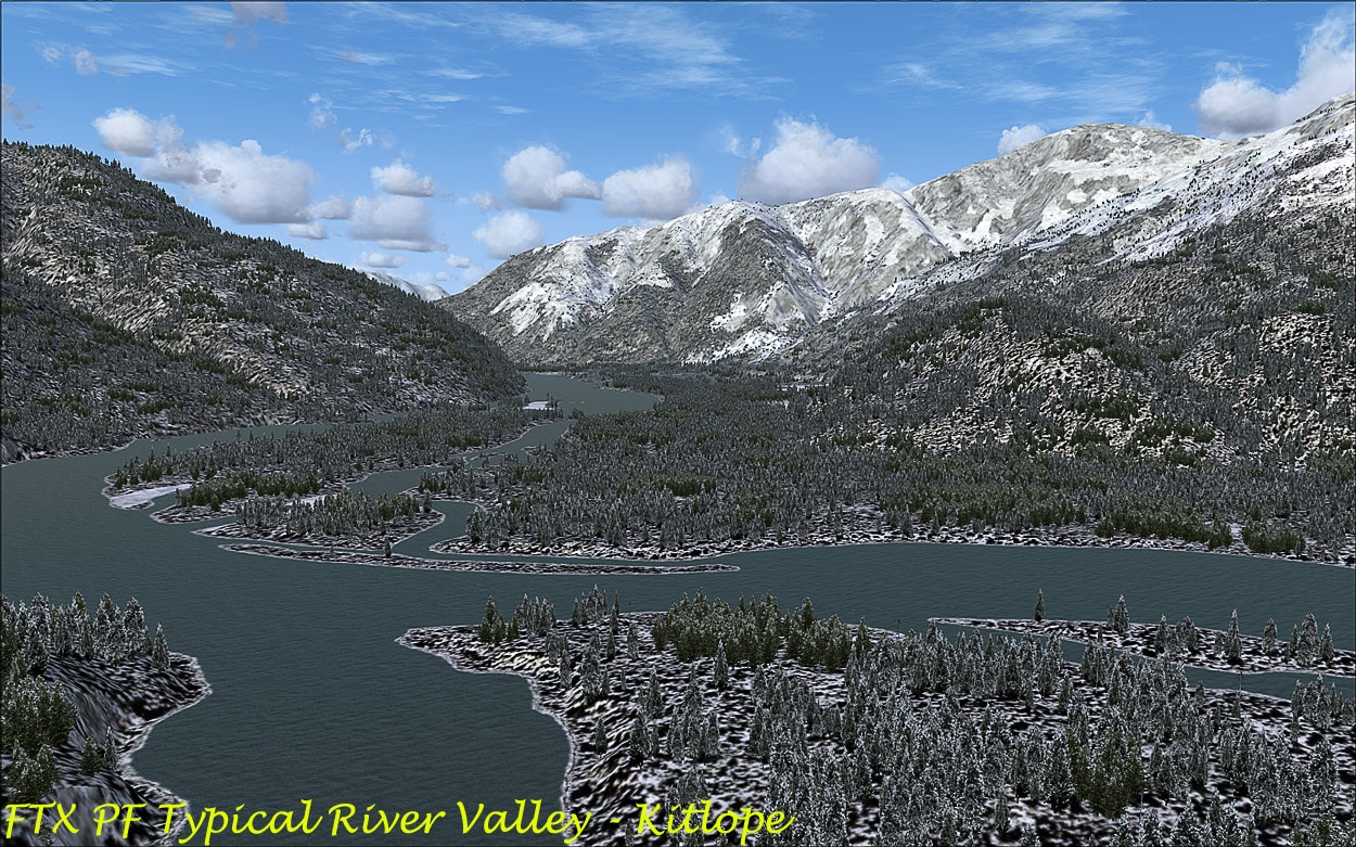
The Rivers, Lakes, Ski fields, Icefields and Glaciers:
According to the user guides there are over 500 ‘photoreal glaciers depicted so there are quite a few to visit and can all be found via the kmz. The various pictures above show some of these elements. The rivers and fjords are beautifully rendered and more than one simmer has commented on their accurate placement. The kmz is a great place to start.
The proposed Service Pack for PF:
This will include
- 40+ custom designed local US Forest Service cabins
- the floatplane dock and helipad near Shoal Cove MORAN station
- full coverage of marine lights and lighthouses)
- a bunch more road and railroad bridges
- any bug fixes requested by users
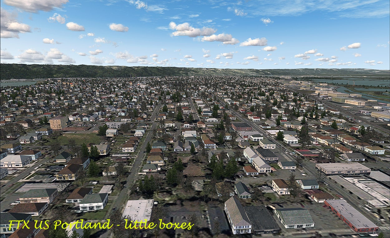
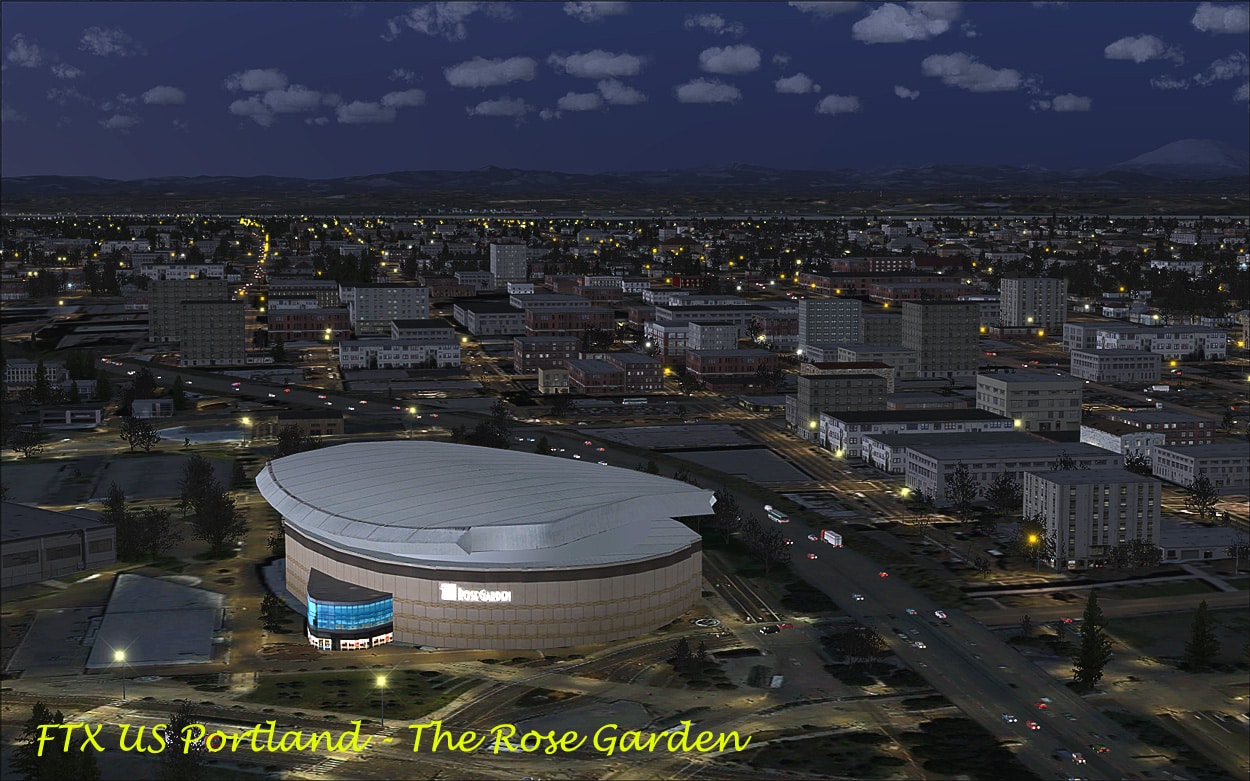
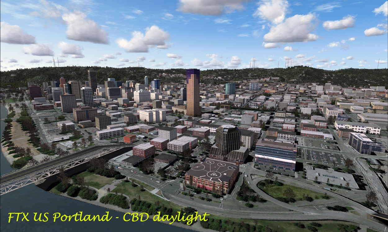
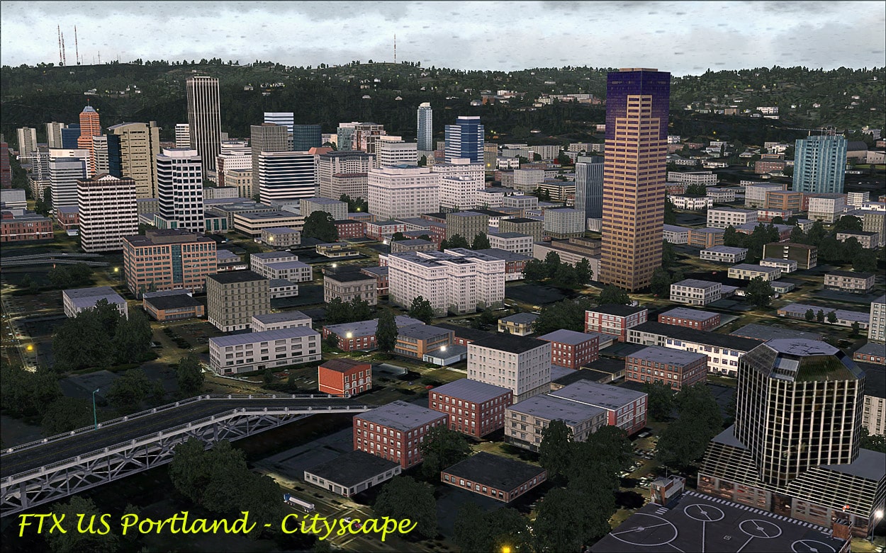
US Portland — free add-on (http://fullterrain.com/freeware.html):
Just as I was wrapping up this review ORBX/FTX released another free add-on for PNW, namely, US Portland. This installs into its own folder under ORBX as KPDX_Cityscape. This is a phenomenal rendition of downtown Portland, i.e. the city itself including the CBD, all in glorious high detail 3D. Even the rail yards and railroads look good! The free software does not include Portland International Airport KPDX, apparently a payware version is being developed by Bill Womack and will be released in the future.  The buildings, bridges and AI traffic look great day or night and a helicopter (or the ubiquitous “Bob” at ground level) is the best way to see them all. The Rose Garden is particularly nice rendition of a building in the CBD!


Summing Up:
Another great couple of add-on scenery from the ORBX team, it would take a lifetime to explore all of the areas and my brief review just can’t do it justice. There is realism aplenty and it blends in nicely with the surrounding areas and is superb for low ‘n slow flying. It really is great to now have Misty Fjords as well as Tongass Fjords back in the flight sim world. Again these two areas are another must have for the GA flyer it really does enhance the flying experience. I look forward to seeing the service pack for PF as that promises to be another bag of goodies from this talented team.
WOW Factor: 9½ out of 10 again.
Peter Hayes, Australia, February, 2011.
The Important Bits:
- Publisher:Â Â Â Â Â Â Â Â Â Â Â Â Â Â Â Â Â Â Â Â Â Â Â Â Â Â Â Â Â Full Terrain FTX – Orbx
- Supplier:Â Â Â Â Â Â Â Â Â Â Â Â Â Â Â Â Â Â Â Â Â Â Â Â Â Â Â Â Â Â Â Â Boxed versions as available from simMarket: PF and PNW
- Download & Boxed:Â Â Â Â Â Â Â Â Â Â Â Â Â Â FSS: PNW and PF
- Download File Size:Â Â Â Â Â Â Â Â Â Â Â Â Â Â PNW: 4.21 GB (exe file) Â PF: 1.6 GB (exe from zip file)
- Installation File Size:            ≈11.0 GB scenery and texture files in various folders. including:
- On the desktop FTX Central North America containing the
PNW and PFUser Guides plus various settings - Simulator Requirement:Â Â Â Â Â FSX SP2 Acceleration Gold DX10 not supported.
- OS Requirements:Â Â Â Â Â Â Â Â Â Â Â Â Â Â Â Win XP, Vista and/or Win 7; Microsoft .NET Framework v3.5
- Testing System:Â Â Â Â Â Â Â Â Â Â Â Â Â Â Â Â Â Â Â Intel i7 860, 8 GB DDR 1600 RAM, Windows 7, nVidia
- GTX460 1GB, 260.99 Driver, nVidia Inspector 1.94;
- FSX SP1 + SP2; 120GB SATA II OCZ Colossus SSD; Saitek X52 + Pro Pedals,
No Tweaks all standard and no over-clocking. - Scenery:Â Â Â Â Â Â Â Â Â Â Â Â Â Â Â Â Â Â Â Â Â Â Â Â Â Â Â Â Â Â Â Orbx FTX NA Blue USA/Canada PNW & PF
- Supplementary:Â Â Â Â Â Â Â Â Â Â Â Â Â Â Â Â Â Â Always install the Orbx Object Libraries app file at the end of each install.
- Installation:Â Â Â Â Â Â Â Â Â Â Â Â Â Â Â Â Â Â Â Â Â Â Â Â Â Â Automatic via a self extracting “exe” file, entering order number,
date and code. A manual install is also possible. - Documentation:                   User Guides: PF 26pp as pdf, PNW 26pp as pdf.
- Support:Â Â Â Â Â Â Â Â Â Â Â Â Â Â Â Â Â Â Â Â Â Â Â Â Â Â Â Â Â Â Â FTX Payware Forum
- Main Forum:Â Â Â Â Â Â Â Â Â Â Â Â Â Â Â Â Â Â Â Â Â Â Â Â Main
- Updates:Â Â Â Â Â Â Â Â Â Â Â Â Â Â Â Â Â Â Â Â Â Â Â Â Â Â Â Â Â Â Â Service Pack? Soon!
- PNW.003 (a) Patch: Â Â Â Â Â Â Patch
- Orbx Object Libraries:Â Â Â Â Â Â Â Â ORBXLIBS
- Aircraft used:Â Â Â Â Â Â Â Â Â Â Â Â Â Â Â Â Â Â Â Â Â Â Â LionHeart Quest Kodiak; Real Air Scout; Carenado C206 Amphib
Thanks:
Thanks to HolgerS for pointing me in the right direction on how to find the location of the fire-towers, cabins and helipads.
The Six Forestry Cabins depicted in ORBX-FTX PF:
- 1.    Humpback Lake: Location: 48 air miles (77 km) southeast of Ketchikan on the mainland east of Mink Bay
Longitude: -130.54  Latitude: 55.0275 - 2.    Manzanita Lake Location: 28 air miles (45 km) northeast of Ketchikan on the scenic northwest arm of Manzanita Lake.
Longitude: -131.0986111  Latitude: 55.58833333 - 3.    Phocena Bay: Location: 15 air miles (24 km) and 25 water miles (40 km) from Ketchikan, on the south shore of Phocena Bay.
Longitude: -131.8044444  Latitude: 55.17638889 - 4.    Trollers Cove: Location: E side Prince of Wales Island, 21 miles (34 km) from Craig, 38 miles (61 km) from Ketchikan.
Longitude: -132.1952778 Latitude: 55.36388889 - 5.    Wilson View: Location: 44 air miles east of Ketchikan on the mainland north of Wilson Arm at the north end of Wilson Lake, elev. 256’.
Longitude: -130.5233333Â Â Latitude: 55.54027778 - 6. Reflection Lake: Location: 50 air miles (80 km) from Ketchikan, on the Cleveland Peninsula northwest of Short Bay.
Longitude: -131.565Â Â Latitude: 56.01138889


