


REAL EARTH X – DOLOMITI X — Alpago, Comelico + Tremiti & Pianosa Islands – The Borgian or Limestone Review.
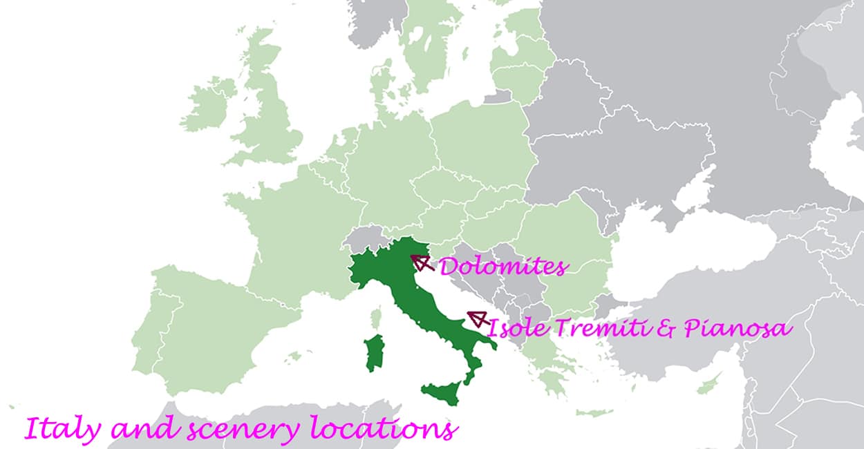
Quick Summary: Real Earth X has produced three very nice scenery add-ons is for Italy: Alpago and Comelico and are in the Dolomiti region of Italy and the Tremiti & Pianosa Islands are located in the Adriatic Sea. This review will give me a chance to fly in an area that I don’t normally have the opportunity to do so. The Dolomites region of Italy is a mountainous region with many ski fields, forests, mountains and high altitude villages. The Tremiti and Pianosa Islands are situated much further south in the warmer waters of the Adriatic Sea and in reality are quite small and sparsely populated. I could only find a helicopter base on San Domino in reality the main island. The scenery is exceptional it is extremely well drawn and it gives a great sense of reality when flying. As I have written on many, many previous occasions every time that you use this scenery you will almost certainly discover something that is new.
Installation: Installation is simple if you are using the default folder that is to say you just click on the exe file enter the key code and it installs automatically. However, if you want to install the scenery in any other folder than the default be aware that the installation process does not create the appropriate folders, and you end up installing the scenery in the default FSX scenery and texture folder. This means that you do not have any entries in the default FSX scenery library, in other words you cannot activate the scenery. So in order to install in anything other than the default you need to create 3 directories manually.  Further, to view the scenery at its best, you need to place the three entries at the top of the scenery library.  Again, during testing, I did not notice any performance decrease on my system, and all was very smooth during testing.
Background: Courtesy of Wikipedia and http://www.dolomiti.org/dengl/;
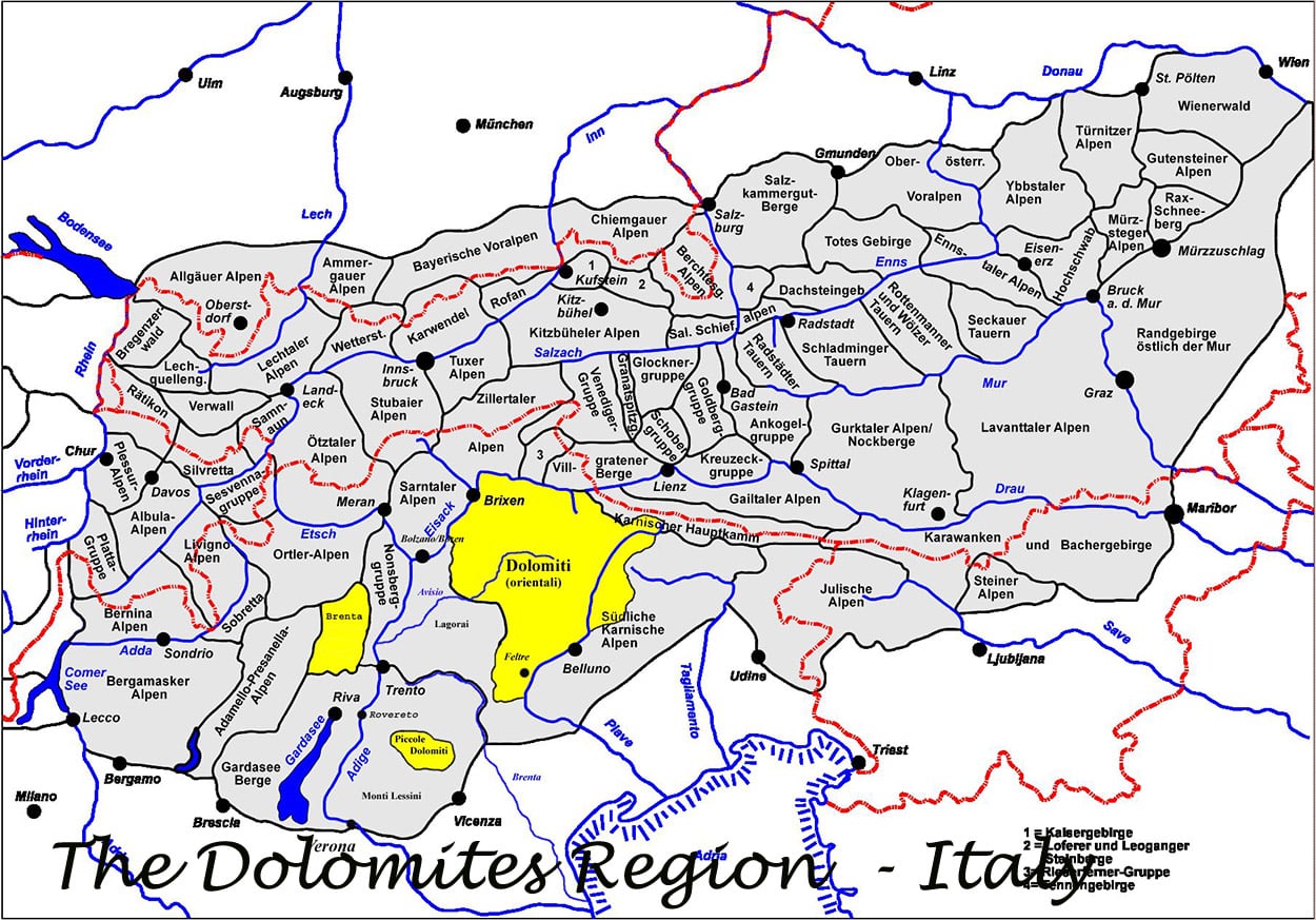
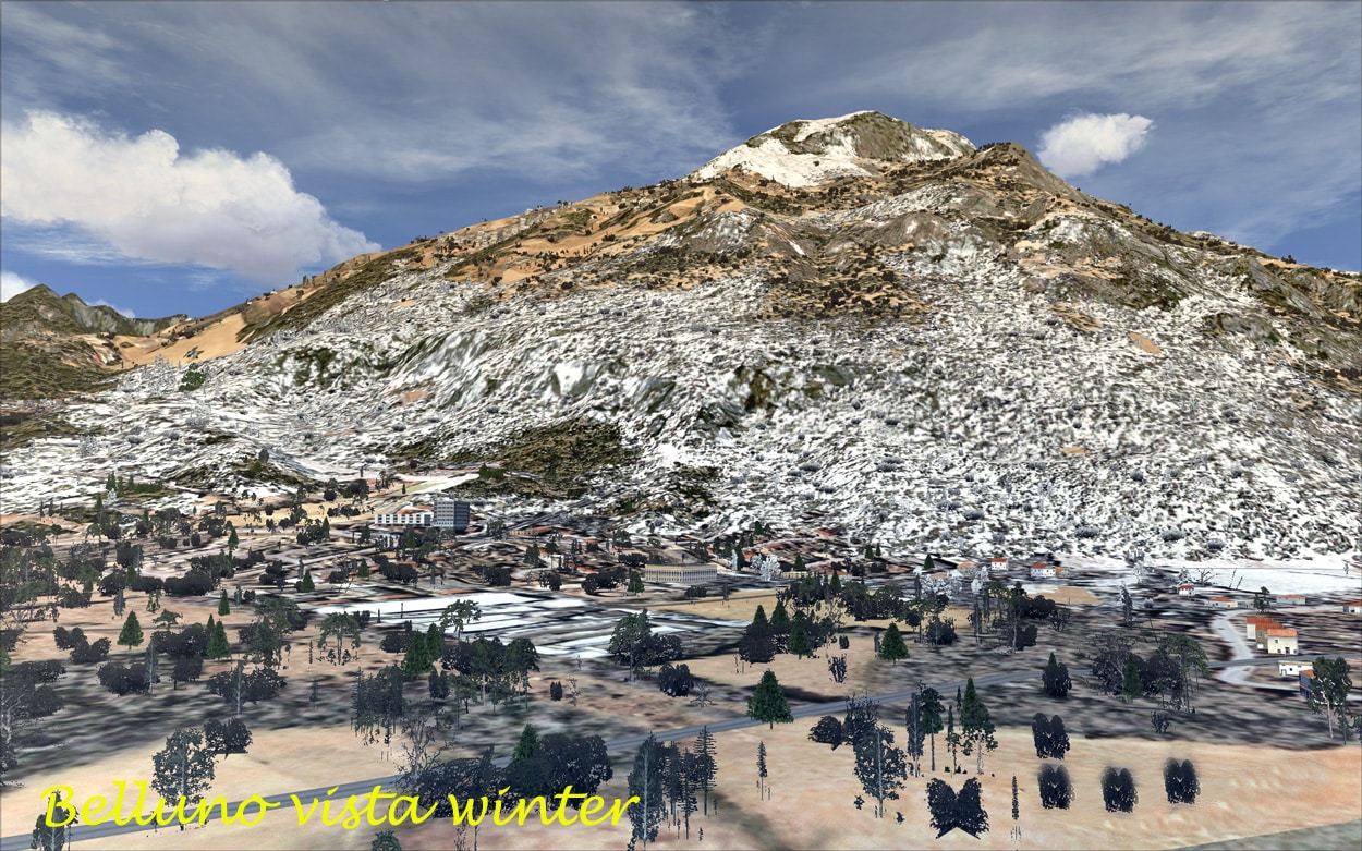
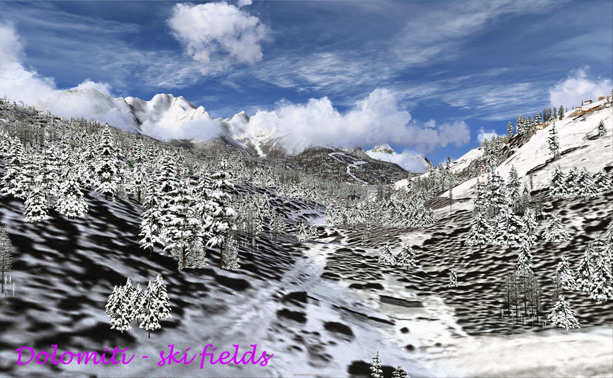
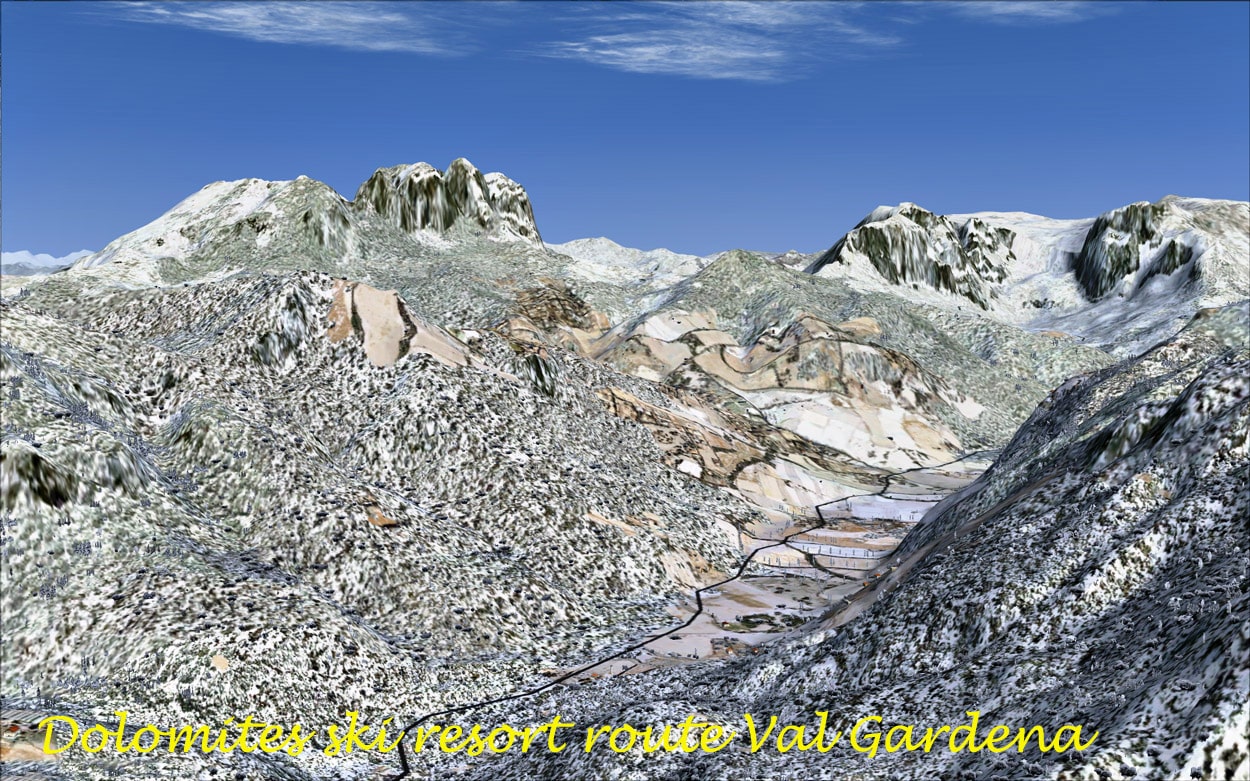
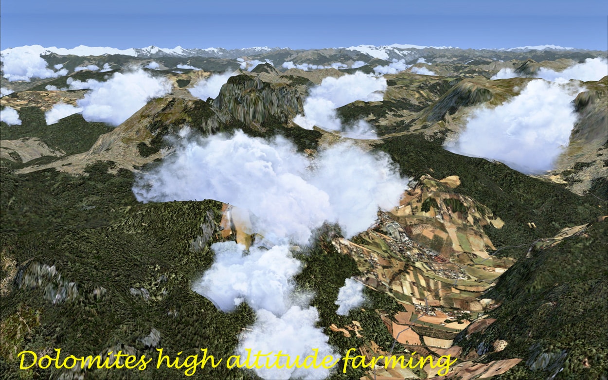
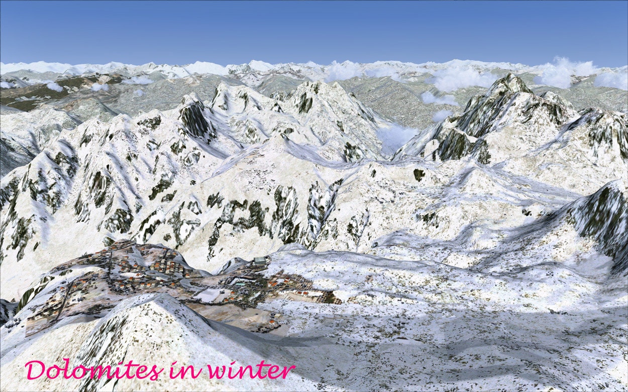
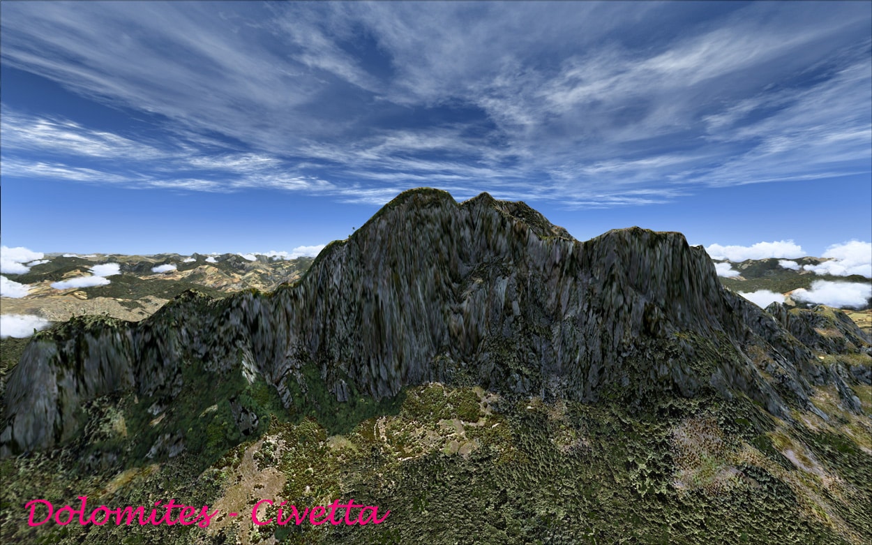
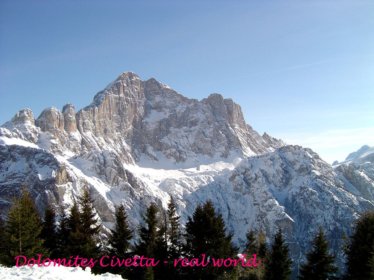
The Dolomites owe their name to a Frenchman, a gentleman called Monsieur Dolomieu, who discovered the chemical composition of the mountain range, in that he was a geologist. In essence, the Dolomites are composed of calcium and magnesium salts, ie carbonates. They were originally called, “The pale Mountains”. The Dolomites are located in the North East part of Italy, having a cool temperate climate with cold snowy winters. The region is a tourist haven with the Dolomites being famous for skiing in the winter months and mountain climbing, hiking, climbing and Base Jumping, as well as paragliding and hang gliding in summer and late spring/early autumn. The main centres include: Rocca Pietore adjacent to the Marmolada Glacier, in the Veneto regions. It includes the small towns of Alleghe, Falcade, Auronzo, Cortina d’Ampezzo and the villages of Arabba, Urtijëi and San Martino di Castrozza, as well as the whole of the Fassa, Gardena and Badia valleys. These are well modelled in the Real Earth X version, with the villages nestling realistically in the mountains. In the winter the mountains and surrounding areas are covered in snow and you can see the various ski fields and the fall colours in the various forests are well done.
In summary the Dolomite Region is an area of great natural beauty and is endowed with abundant scenic resources, and the main industries are in essence tourism.
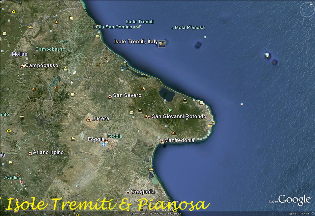
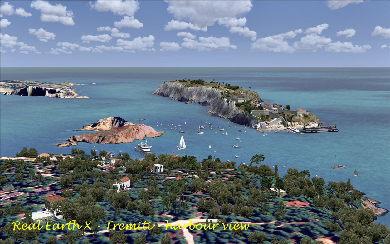
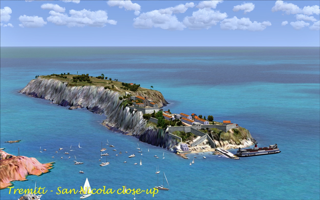
The Isoles Tremiti (Tremiti and Pianosa Islands) are an archipelago in the Adriatic Sea, north of the Gargano Peninsula. The islands comprise:
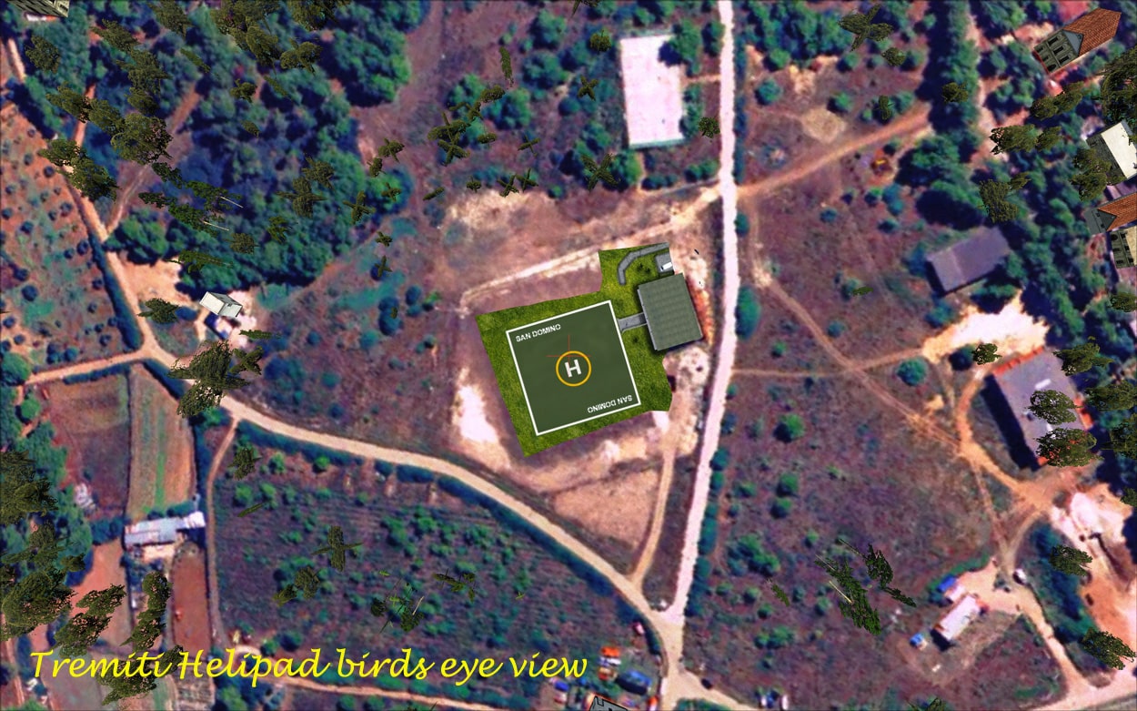
- San Domino — well developed tourism island and has the only sand beach in the archipelago.
- San Nicola – most populated and is the site of a monastery where the monk Nicolò is buried.
- Capraia (or Capperaia) – deserted.
- Cretaccio is a big slab of clay and is uninhabited.
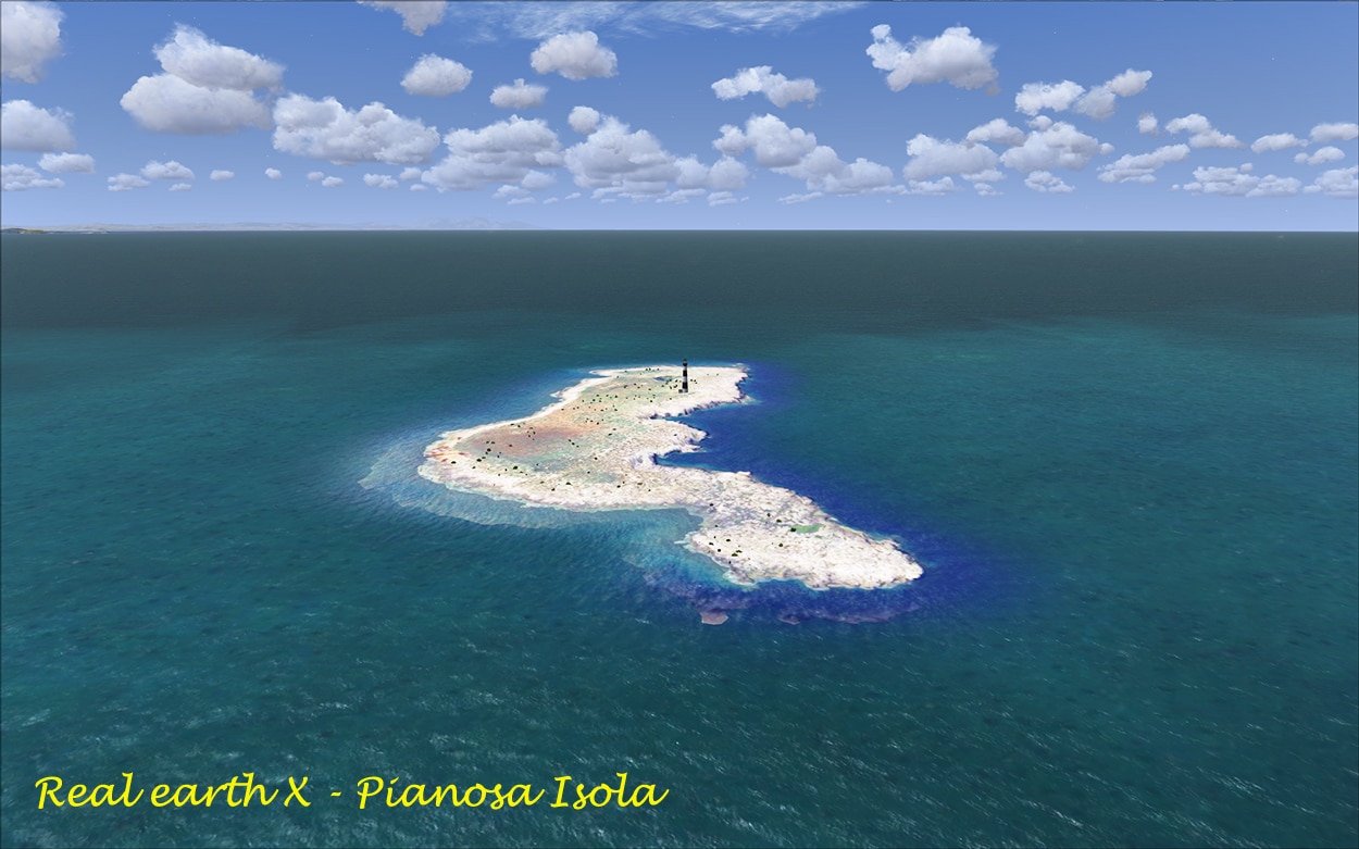
- Pianosa is a small, uninhabited isand. Max Elev, 15m and sometimes, during storms, the waves cover it. (See map attached.)
The Manual:
There is no manual. In my opinion this is quite an emission, as not being Italian meant that I did not know very much about this area and it would have been great for the developers to highlight the best features of their scenery including any of the airports or airfields that they have updated. There is a hard to read pdf file of the “Belluno” region, and if you print it out on A4 paper and it is almost impossible to read.
In the Sim:
The scenery areas must be located at the top of the scenery library in order to display correctly.
Visually speaking:
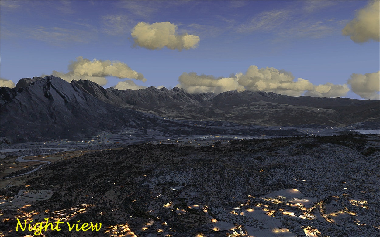
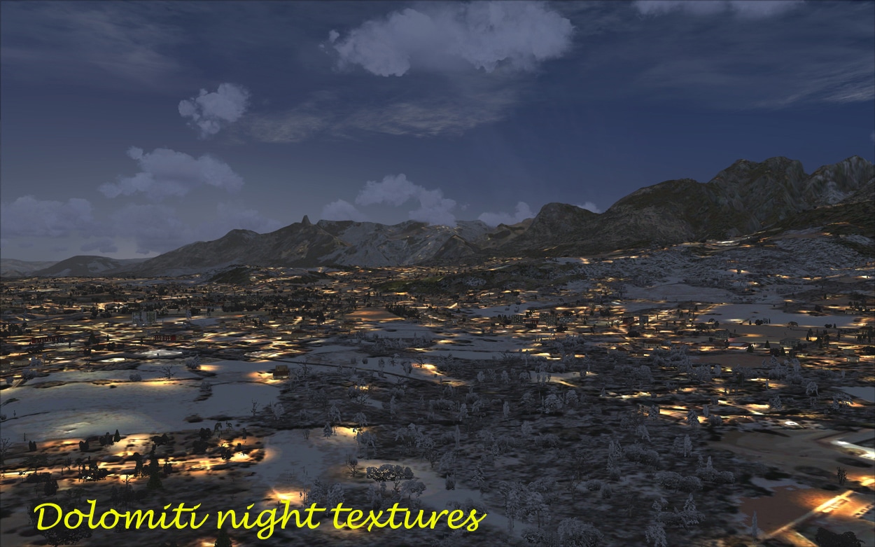
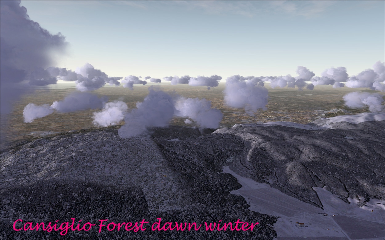
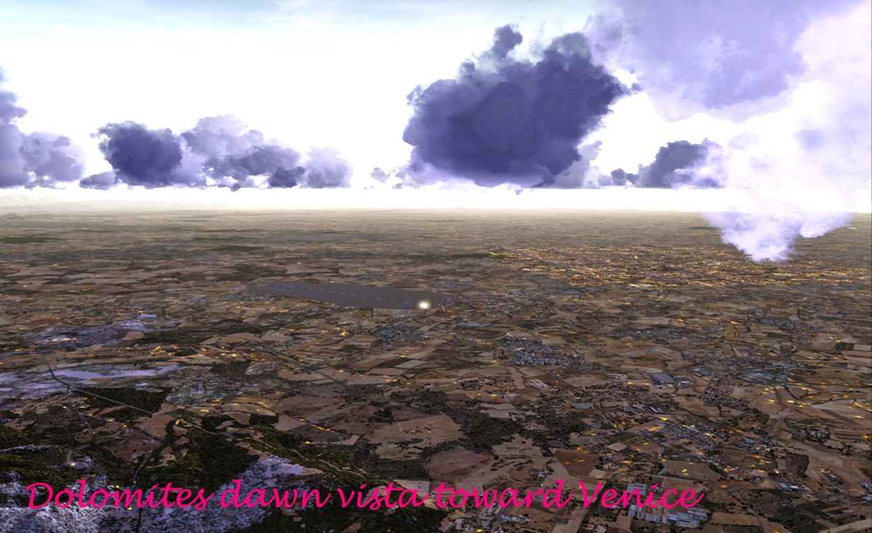
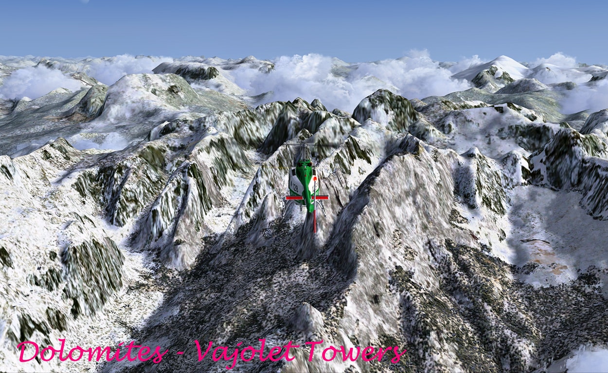
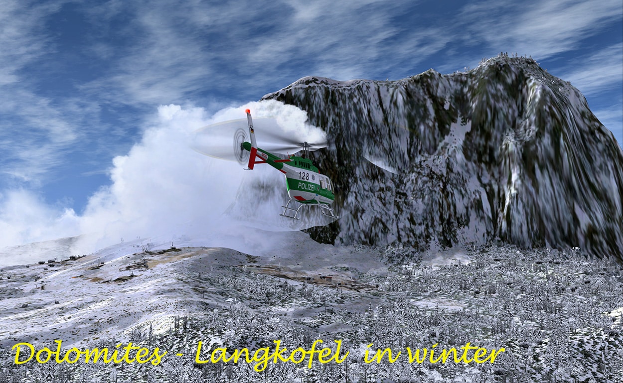
All three scenery packages transform the default scenery into something approaching what we would see if we lived in or visited the area. Using my usual settings we can see well depicted areas of forests, mountains, bridges, roads, creeks streams and rivers placed geographically accurately. IMHO, the scenery package is best displayed in the winter or spring around dusk or dawn. The mountains and valleys are truly spectacular and I was using the default Bell helicopter and I felt I was almost there. The trees are very well modelled, and seem to represent the sylvan depiction that you would find in real life. The colours in spring were also quite spectacular you could almost smell the blossoms as you flew amongst the alpine pastures. Without snow in the mountains look amazing and you can see in this add-on why they are called the Dolomites. I did not spot any animals, and are plenty of animals in the real Dolomites, so perhaps they were not modelled. Shame! The fall colours were also excellent. The villages were lovely, they nestle in amongst the mountains almost clinging to life itself and the buildings were quite varied, depicting I guess, what you would find in real life. There are lots of lakes in the region, and again these are well depicted being both geographically and navigationally correct. There are also plenty of cable cars in the Dolomites region, but again I did not spot any. The night textures are very well represented and they look quite realistic. [Reviewer’s note: The 3 Peaks screenshot is of the default FSX scenery and Real Earth X have this area under development, which looks phenomenal.)
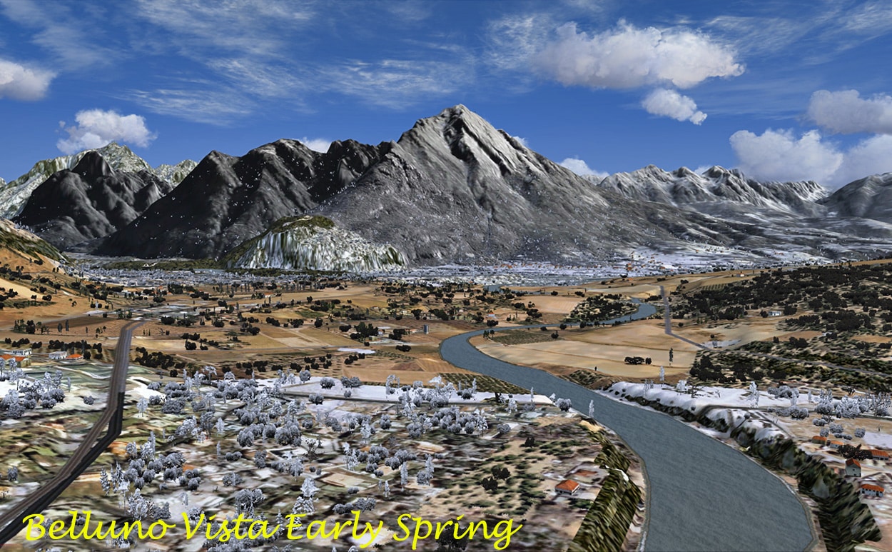
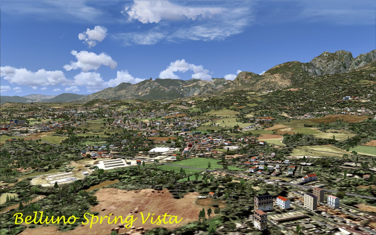

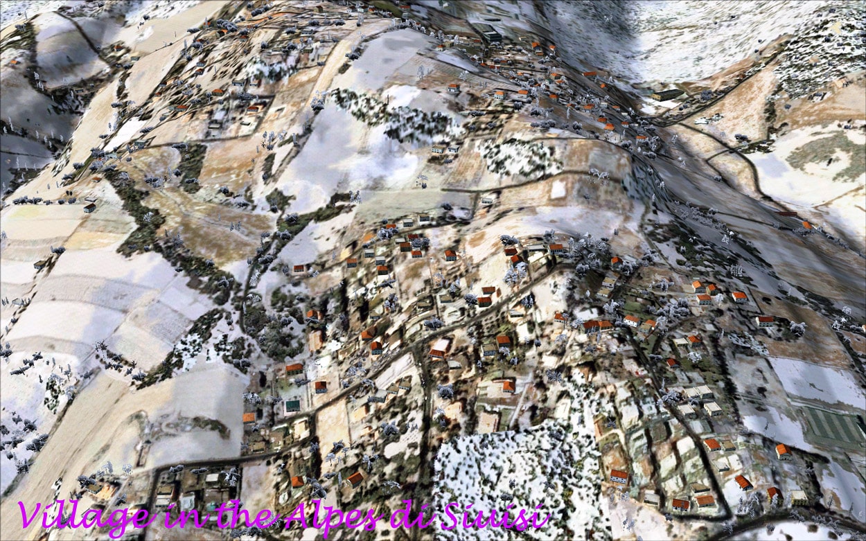
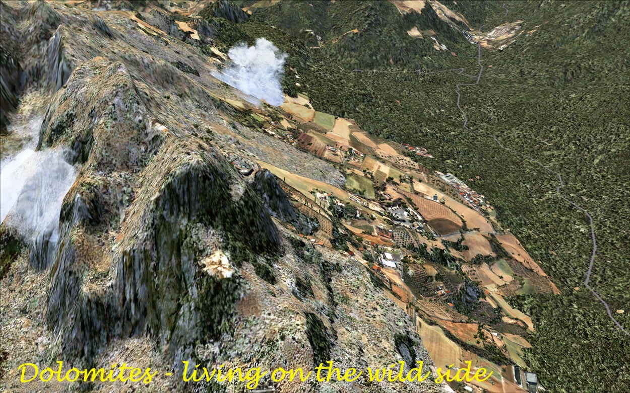
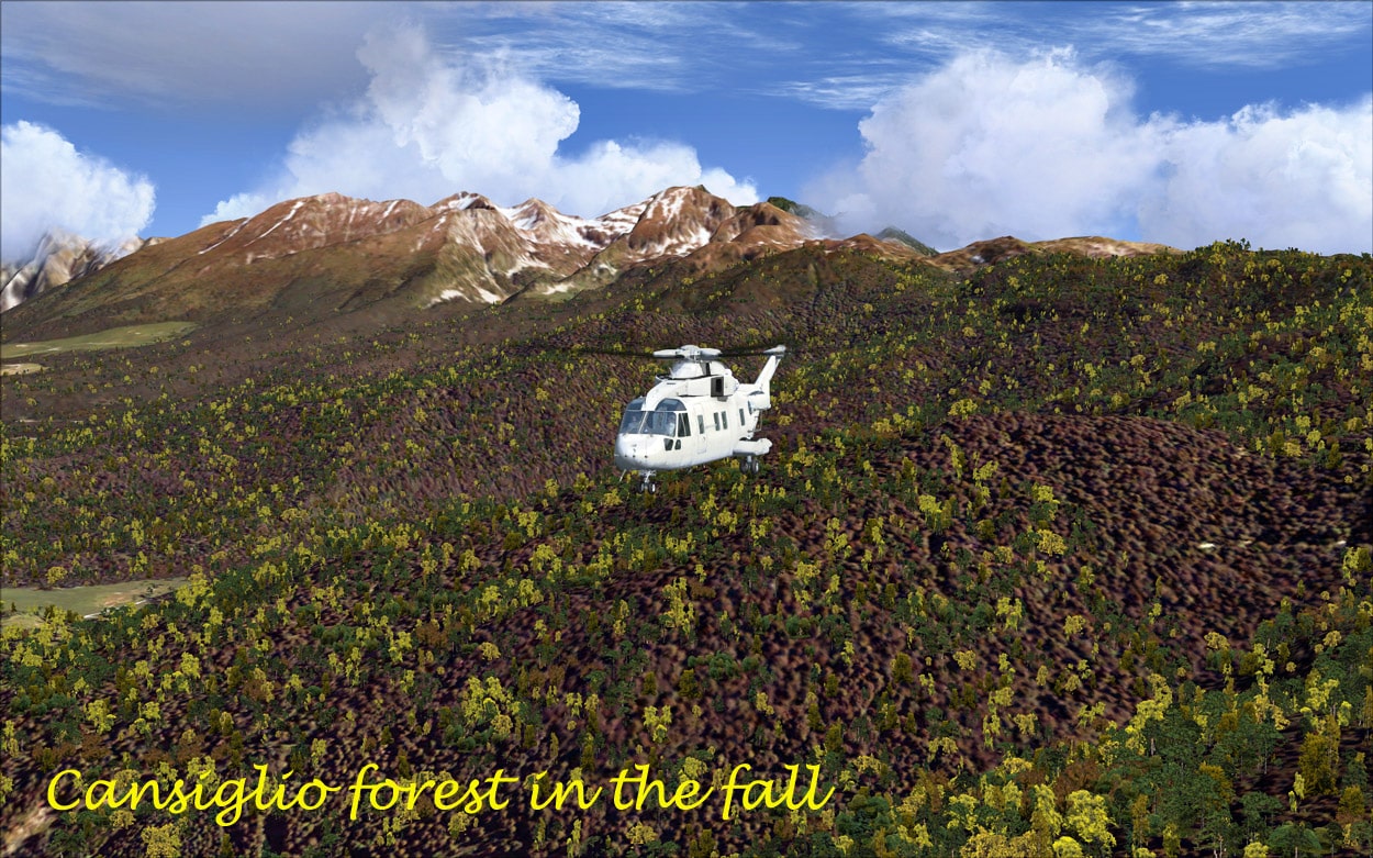
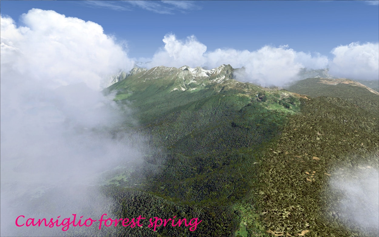
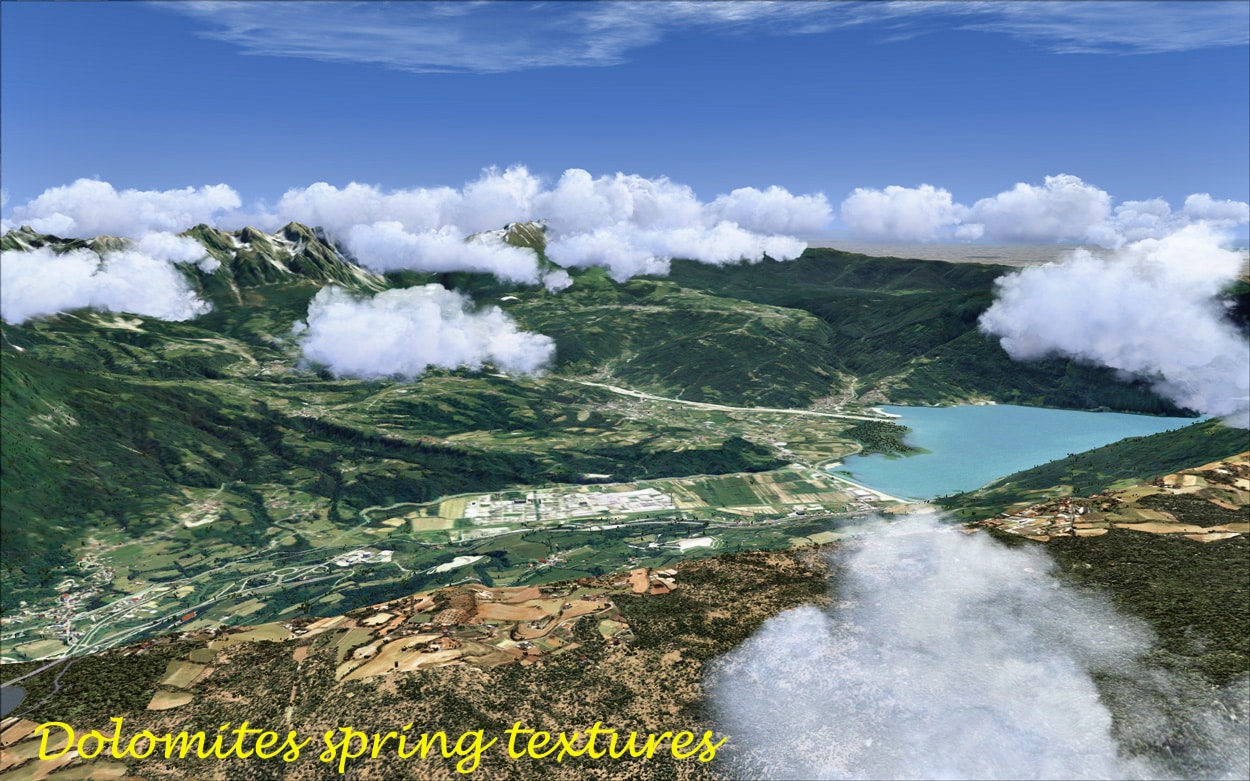

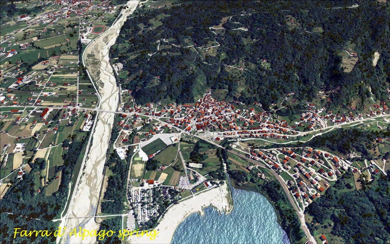
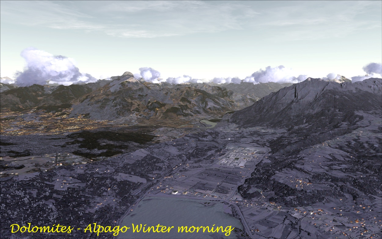
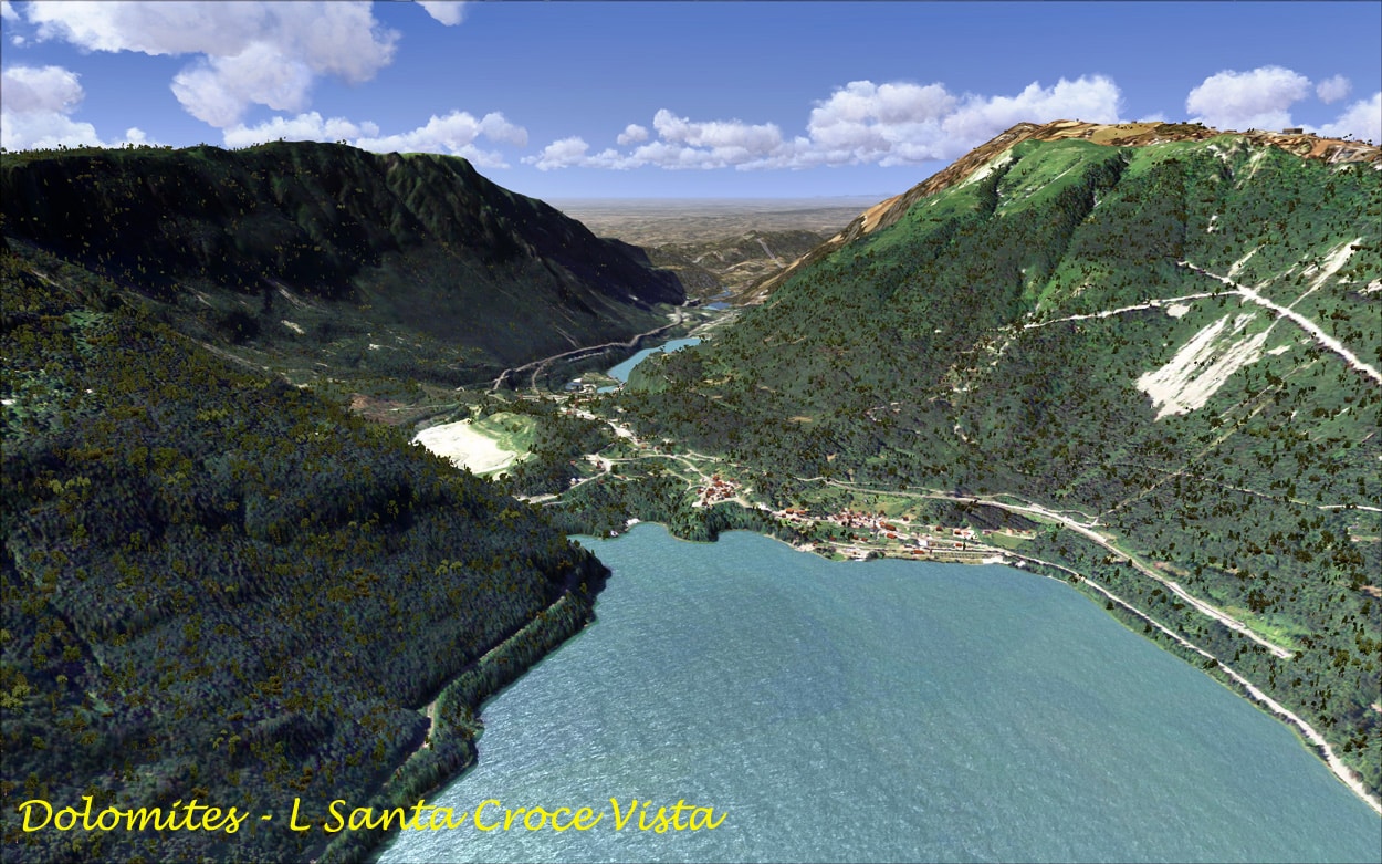
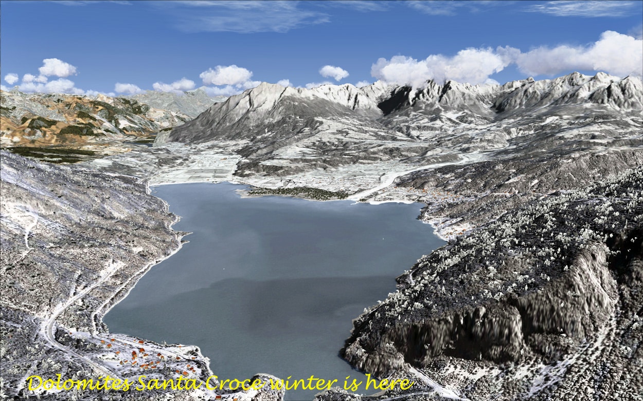
Alpago nestles at the foot of the Dolomites and it is set in some of Europe’s finest scenery and again, real Earth X has done a wonderful job in representing the area in flight simulator X. Alpago sits on the edge of Lake Santa Croce which is the largest natural lake in the Veneto, and is overlooked by the famous Bosco Del Cansiglio Mountain. I had a great flight in the default Bell helicopter from Alpago to Belluno along the shores of Lake Santa Croce, the scenery was amazing. Real Earth X has done an excellent job in the Alpago add-on. Everything looks gorgeous and the colours are quite vivid almost 3-like. The season is well represented, as are the night textures.
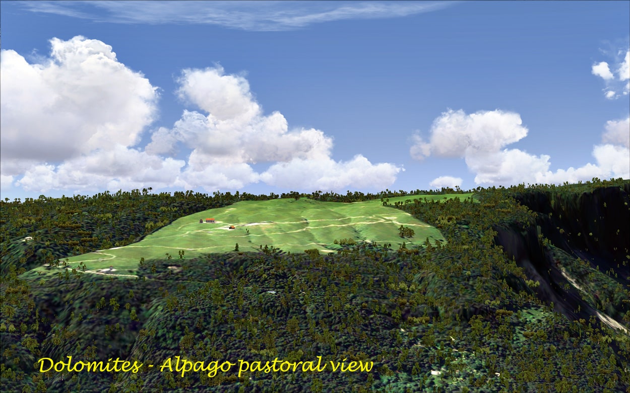
Comelico superiore is about 130 km north of Venice and about 60 km northeast of Belluno, on the border with Austria. It is a typical Mountains ski resort yet principally for the winter tourist. Real Earth X has done a wonderful job in depicting this marvellous area. There are mountains all around, and these are quite spectacular. The population is quite small being less than 3000 of the town is surrounded by forest and lush green meadows and it has the characteristic mountain style houses which are real Earth X have captured completely. There are several villages in the region and it is quite fantastic to fly to all of them by helicopter. One such village is Padola, which is a charming environment nestling in an alpine valley about 4000 feet above sea level. You can see the ski fields and ski trails set amongst the snow laden fir trees. The whole region is surrounded and in fact is amongst some of the biggest mountains in Europe. There are many high alpine meadows in the region and these look magnificent in the scenery.
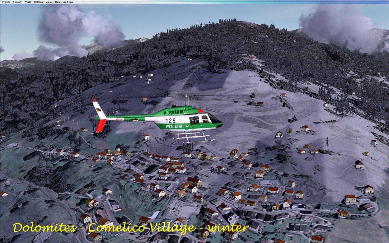
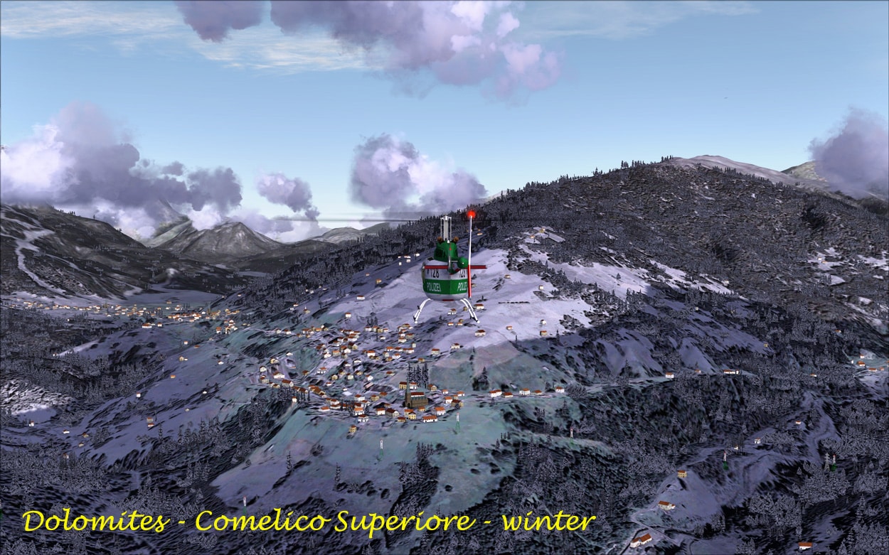
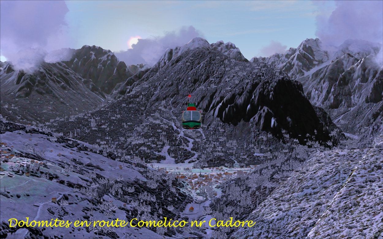
I have included some pictures which I hope will show how well this area has been depicted by the real Earth X team.
Tremiti & Pianosa:
The Tremiti and Pianosa Islands are also very good, and again I used a helicopter to explore these islands. Naturally, due to the terrain, they are quite sparse in terms of buildings and other features. However what is there, is great, the team have done another fantastic job. The only way round these islands is to use a helicopter and flight simulator X is two or three good ones which I used to great effect.
The Airfields:
There are quite a few airfields in the scenery packages, but I am not sure if these of the default airfields or have been modified by the real Earth X team. As I said earlier, on TREMITI there is a helicopter base and this looks like it has been modelled by the real Earth X team. I have to admit that I concentrated on the splendours of the natural scenery rather than looking at the technical aspects of the airfields. Most seem suited to VFR flying, with by far the best way to get around is to use the helicopter.
Overall:
In my mind, the scenery packages are of excellent quality I thoroughly enjoyed flying around them, and time and time again I discovered something new I hope that my screen shots will do justice to this nice piece of software.
Sounds:
I did not notice any particular ambient sounds.
Support:
This is by email and was quite effective. However, the language difference did make it difficult to get my point of view over. To my eternal regret I do not speak Italian and the fault was mine rather than the developers, and to be fair they did try to answer my concerns. In fact my only concern was the fact that the installation procedure was not as good as it should be if you did not install the scenery to the default location. Once I realised that, I created the necessary folders and the installation proceeded smoothly. There is a forum mainly in Italian with some English, but I had a lot of trouble getting into the forum, it just didn’t want to open.
Summing Up:
These three packages of very good and I definitely think that they enhanced the flight simulator experience. My brief review is just that brief and there was a lot undiscovered ‘goodies that I didn’t get to see. As I have said on many previous occasions, every time that I flew I saw something new. This is another VFR package and I used the helicopter to get around. In all my years using flight simulator X I had never flown in Italy, and these scenery packages made it an excellent experience. I liked what real Earth X has done and hope that they continue to bring out new scenery add-ons.
WOW Factor: 8 out of 10!
Peter Hayes, Australia, March 2011
A Collection of the Important Bits:
- Publisher: Real Earth X
- Supplier: simMarket
- Download File Size: Alpago: 1.2GB; Comelico 1.2GB; Tremiti Isoles 21MB.
- Installed File Size: Alpago: 1.2GB; Comelico 1.25GB; Tremiti Isoles 33MB.
- Simulator Requirement: FSX no mention of service packs
- OS Requirements: Win XP, Vista and/or Win 7;
- Testing System: Intel E8600, 4GB DDR 800 RAM, Vista 64 SP2,
nVidia GTX260 GT, nVidia 258.96 Driver;
FSX SP1 + SP2; 500GB SATA II Seagate Momentus X HDD.
No tweaks all standard and no over-clocking. - Scenery: FSX Default; FS Genesis, UTX USA/Canada; GEXn; X-Graphics,
plus OrbX “BOB” - Installation: Automatic via a self extracting “exe” file, entering a key code.
- Manual: One “Belluno” pdf file
- Demo: N/A
- Support: email
- Homepage: here
- Forum: http:here
- Updates N/A
- Uninstall Uninstall.exe supplied


0 Responses
Hi Peter,
thank you.
I saw some pictures: for example the Three Peaks are under development. The mesh and textures are by default. Here http://www.youtube.com/watch?v=p411uXKWgZE you can see an example.
Daniele
Daniele
Nice software I tried very hard to get a good pic of 3 peaks but I just couldn’t pin one down and I didn’t realise that was the default mesh. I thought at the time that it didn’t look “right”.Good luck with future releases.
PeterH
WOW the you tube vid looks great!! Don’t forget to send me the update!