

A new version of the mobile app FS Navigation Map has been released. Its aim is to quickly give essential information about airports and navaids before and during simulation flights.
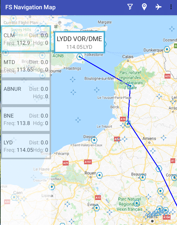
With FS Navigation Map, the user can see over a map where airports, ILS, VORs, NDBs and waypoints are located, together with relevant information like frequencies, heading (for ILS), etc. and the ability to search for specific spots.
This new version, apart than some fixes, includes a completely few feature: support for Flight Plans. They can be created manually directly from the app or be sent automatically from the simulator when the flight is started.
If you want to give it a try, you can check the Google Play page.
Or our website to find more information and download the FSX/Prepar3D or X-Plane plugins : https://www.drubware.net.


