


From the Navigraph team: “Explore the U.S. with higher realism! Sectional charts from the Federal Aviation Administration (FAA) have officially landed on the Navigraph Charts platform. ![]()
Discover Sectional Charts ![]()
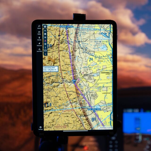
Ever wondered what those colorful charts are all about? FAA sectional charts give you a bird’s-eye view of crucial details like elevations, landmarks, and airspace classifications. Think of it as having your personal guide revealing all the secrets of the terrain from above.
Accessing FAA Charts in Navigraph Charts ![]()
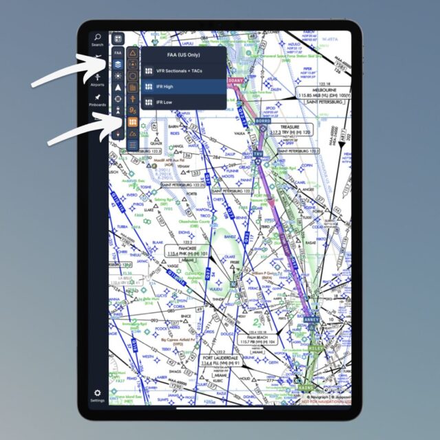
The FAA Sectional (VFR) charts are available on all Charts platforms, including the Charts In-Game Panel for MSFS. You can quickly enable the FAA sectionals right from the Map Presets panel in Charts.
In addition, you can enable FAA IFR High and Low charts using our new FAA Charts category (available on all platforms except the MSFS in-game panel). Open the Map Layers panel, then click the filter icon from the fold-out menu.
Want to learn more? Check out this blog post about the release.


In this video, we take you on an adventure and explore the ins and outs of flying with sectional charts.


